Select Item below to DOWNLOAD - Once item is selected, right click and choose 'save as'
2ef63020-629e-493a-8b88-cc400a893eac
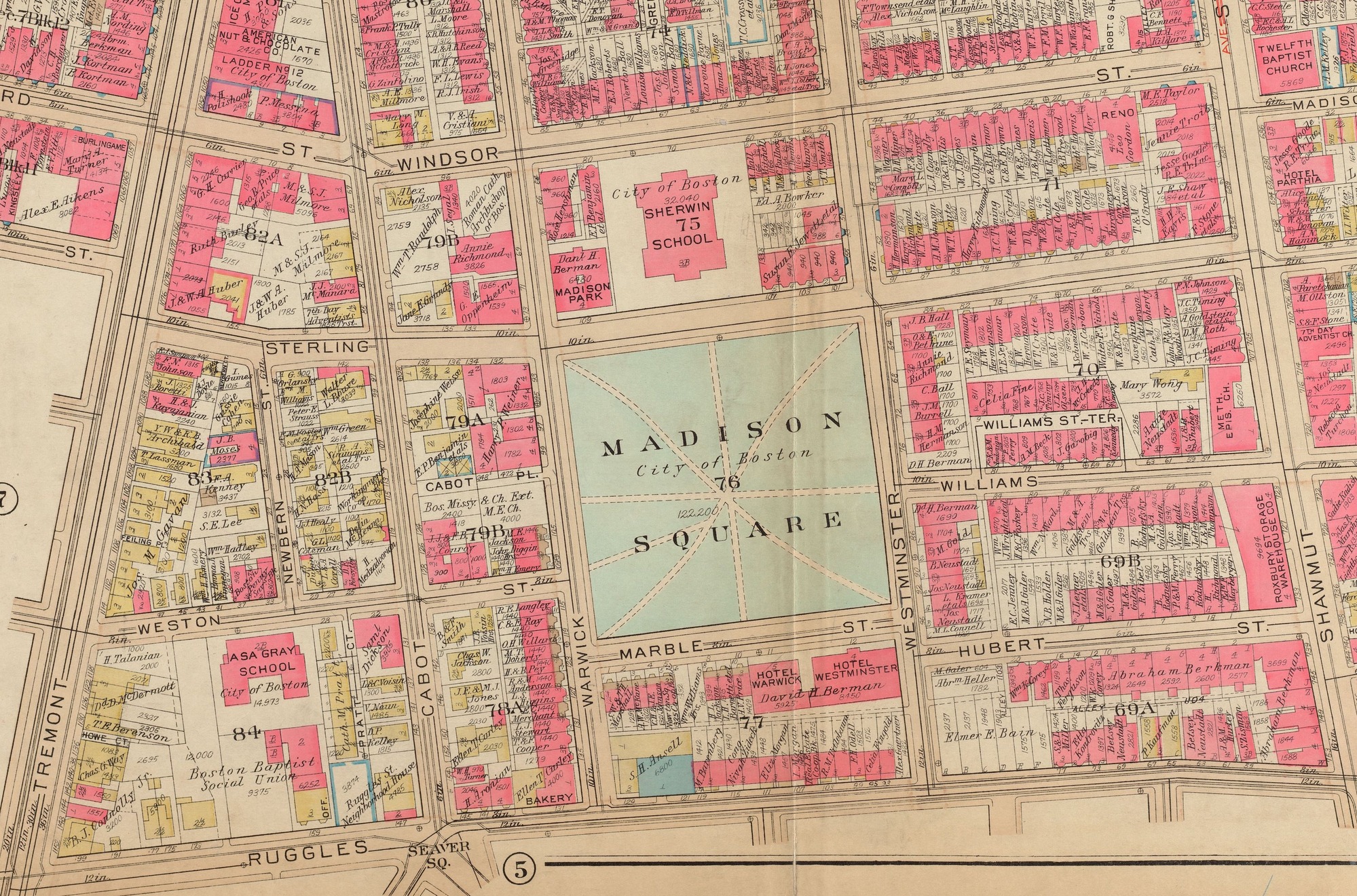
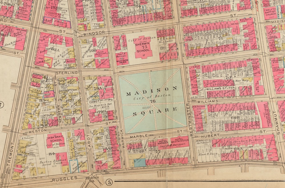
Atlas of the city of Boston, Roxbury : plate 1; 1931
1931 Atlas Map of Roxbury showing Windsor Street.
Cropped version of G.W. Bromley & Co. Map of Roxbury that includes Tremont Street, Hammond Street, Windsor Street, Shawmut Street, and Washington Street.
Philadelphia : G.W. Bromley & Co.
G.W. Bromley & Co.. "Atlas of the city of Boston, Roxbury." Map. 1931. Norman B. Leventhal Map & Education Center, https://collections.leventhalmap.org/search/commonwealth:1257c361w.
Norman B. Leventhal Map Center Collection, Boston Public Library
Public domain
Image
Boston National Historical Park, Code: BOST
Boston National Historical Park, Suffolk County, Massachusetts
Latitude: 42.3734016418457, Longitude: -71.0557022094727
Latitude: 42.3734016418457, Longitude: -71.0557022094727
01/01/1931
01/01/0001
Public Can View
Organization: Norman B. Leventhal Map Center Collection, Boston Public Library
Thursday, May 7, 2020 6:37:49 AM
Thursday, May 7, 2020 6:37:49 AM
TEJ9-WindsorSt.jpg
Monday, January 1, 0001 12:00:00 AM
jpg
3.5 MB
Historic