Select Item below to DOWNLOAD - Once item is selected, right click and choose 'save as'
2e0997c4-dbe8-4ce0-87f5-63ff4d3b2a99
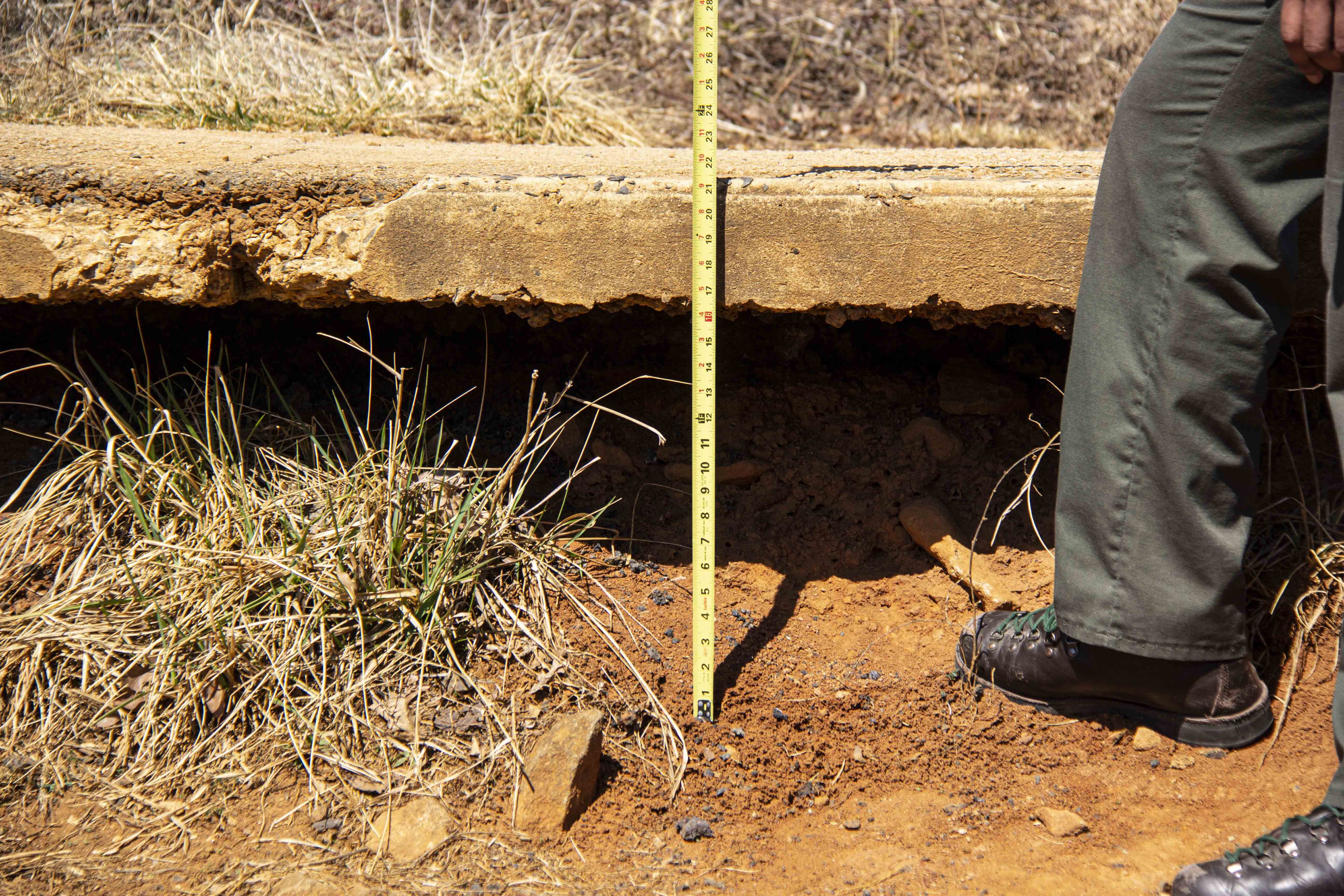
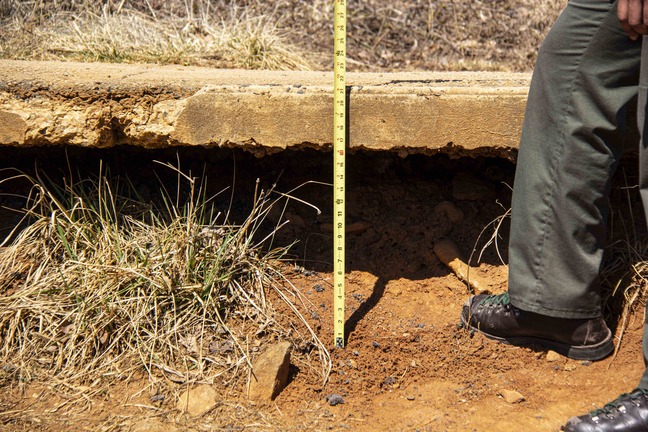
Measuring Major Soil Erosion at Devil’s Den
There is a man in a National Park Service uniform standing in a central frame. He is holding a tape measure which is extending down to the ground along the side of a paved road to his side at a higher elevation. The pavement is up to the man’s knees and looks like it is floating above the ground without any support. The tape measure is determining the distance between the ground and the pavement.
A park ranger uses a tape measure to show how drastic the erosion has been at Devil’s Den. The erosion in this area is so bad that the concrete sidewalk has been undermined by 16 inches in height.
Permission must be secured from the individual copyright owners to reproduce any copyrighted materials contained within this website. Digital assets without any copyright restrictions are public domain.
NPS Photo
Public domain:Full Granting Rights
Image
Gettysburg National Military Park, Code: GETT
Gettysburg National Military Park, Adams County, Pennsylvania
Latitude: 39.804500579834, Longitude: -77.2384033203125
Latitude: 39.804500579834, Longitude: -77.2384033203125
03/16/2022 | Wednesday, March 16, 2022
03/16/2022
Public Can View
Friday, April 29, 2022 8:07:24 PM
Wednesday, May 11, 2022 9:04:55 PM
Jason_3-16-22_0018.jpg
Canon Canon, Canon EOS 60D 200, EF-S18-200mm f/3.5-5.6 IS
1/800 sec at f / 5.6
90 mm
ISO 200
Wednesday, March 16, 2022 1:43:21 PM
jpg
1.1 MB
Scenic