Select Item below to DOWNLOAD - Once item is selected, right click and choose 'save as'
2dfd96a6-3830-4429-8f16-573c35a3a15d
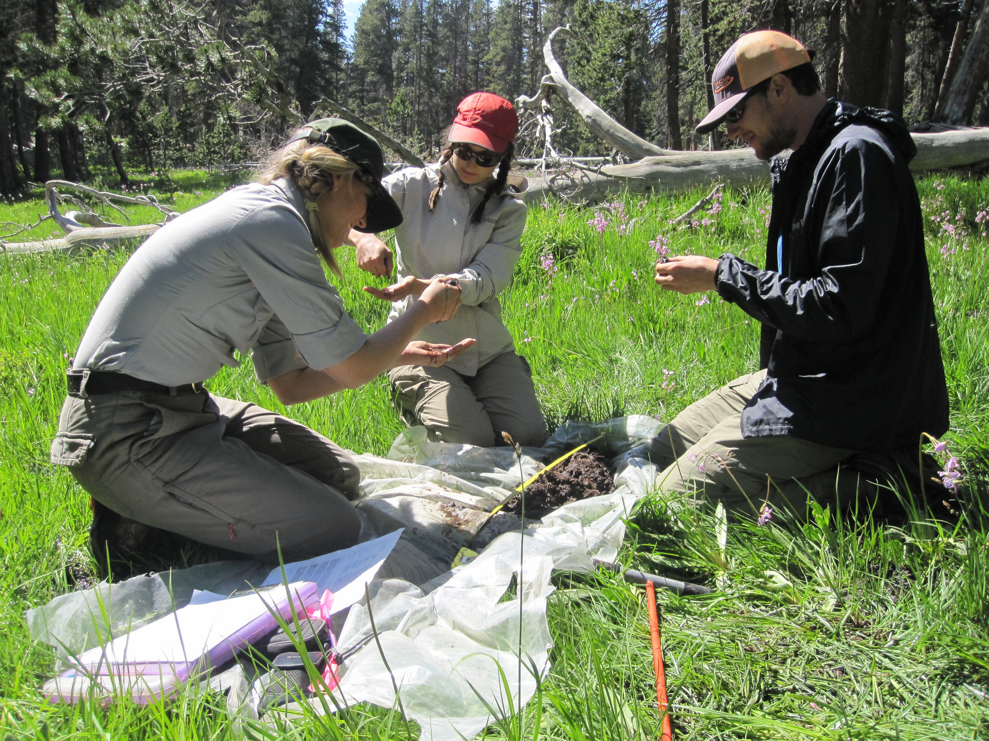
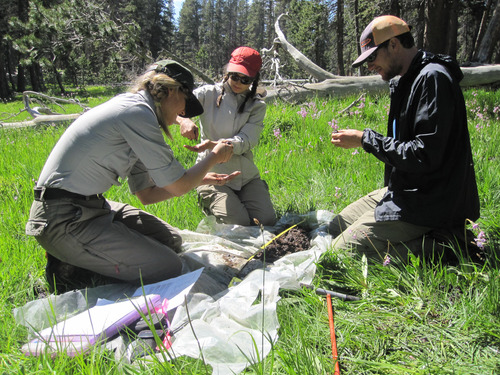
Field crew assesses a soil profile to help categorize the type of wetland they are monitoring, Mitchell Meadow, Sequoia and Kings Canyon National Parks, July 2016.
Field crew of three kneel on plastic tarp in a meadow and examine a soil core.
Evaluating soil profiles helps wetland field crew categorize the type of wetland they are monitoring.
U.S. National Park Service, Sierra Nevada Network
This digital asset is in the public domain. When using this asset for any purpose, including online, credit: 'Courtesy U.S. National Parks'
Public domain
Image
Sequoia and Kings Canyon National Parks, Code: SEKI
Mitchell Meadow, Sequoia an Kings Canyon National Parks
Sequoia and Kings Canyon National Parks, California
Latitude: 36.7172584533691, Longitude: -118.537902832031
Sequoia and Kings Canyon National Parks, California
Latitude: 36.7172584533691, Longitude: -118.537902832031
2016-07-02
07/02/2016
Public Can View
Organization: Sierra Nevada Network
Position: Science Communication Specialist
Address: Sequoia and Kings Canyon National Parks, 47050 Generals Highway, Three Rivers, CA 93271
Position: Science Communication Specialist
Address: Sequoia and Kings Canyon National Parks, 47050 Generals Highway, Three Rivers, CA 93271
Thursday, December 22, 2022 3:56:17 PM
Thursday, December 22, 2022 3:56:17 PM
SoilCore_MitchellMdw_SEKI_LMutch_20160702.JPG
jpg
1.7 MB
Monitoring