Select Item below to DOWNLOAD - Once item is selected, right click and choose 'save as'
2de3cd16-15cc-4d0c-b553-71cbbeb4c7e3
Paleogeography
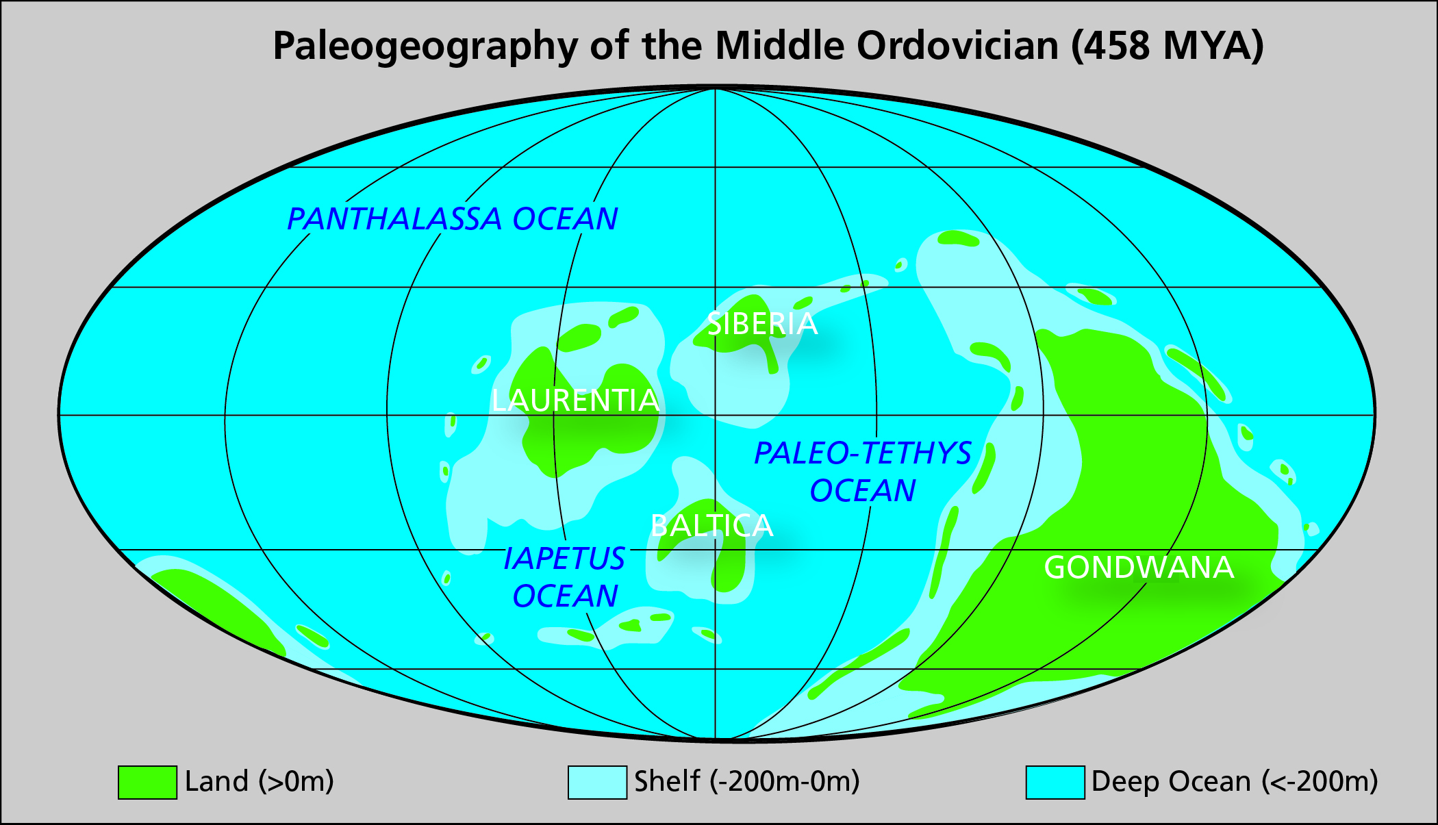
Global map showing the location of extant continents of the Middle Ordovician. Labeled landmasses include Laurentia, Siberia, Baltica, and Gondwana; labeled oceans include Panthalassa, Paleo-Tethys, and Iapetus.
Map showing the paleogeography of the Middle Ordovician (approximately 458 million years ago). Most researchers place western Arctic Alaska next to Siberia, next to Baltica, or in some intermediate position during the early Paleozoic Era (Blodgett et al. 2002; Dumoulin et al. 2002; Amato et al. 2009;
Colpron and Nelson 2009; Strauss et al. 2017).
Permission must be secured from the individual copyright owners to reproduce any copyrighted materials contained within this website. Digital assets without any copyright restrictions are public domain.
NPS
Public domain:Full Granting Rights
Image
Bering Land Bridge National Preserve, Code: BELA
Bering Land Bridge National Preserve, Alaska
Latitude: 66.2151489257813, Longitude: -165.126602172852
Latitude: 66.2151489257813, Longitude: -165.126602172852
01/01/0001
Public Can View
Friday, July 2, 2021 2:51:14 PM
Friday, July 2, 2021 2:51:14 PM
Fig 42_Ordovician Global Paleogeography.jpg
Monday, January 1, 0001 12:00:00 AM
jpg
1.3 MB
Scenic