Select Item below to DOWNLOAD - Once item is selected, right click and choose 'save as'
2baf00b9-1fa6-416c-9e29-bb9a5c4cd8b7
WHHO PRPA Mask Use Requirements.jpg
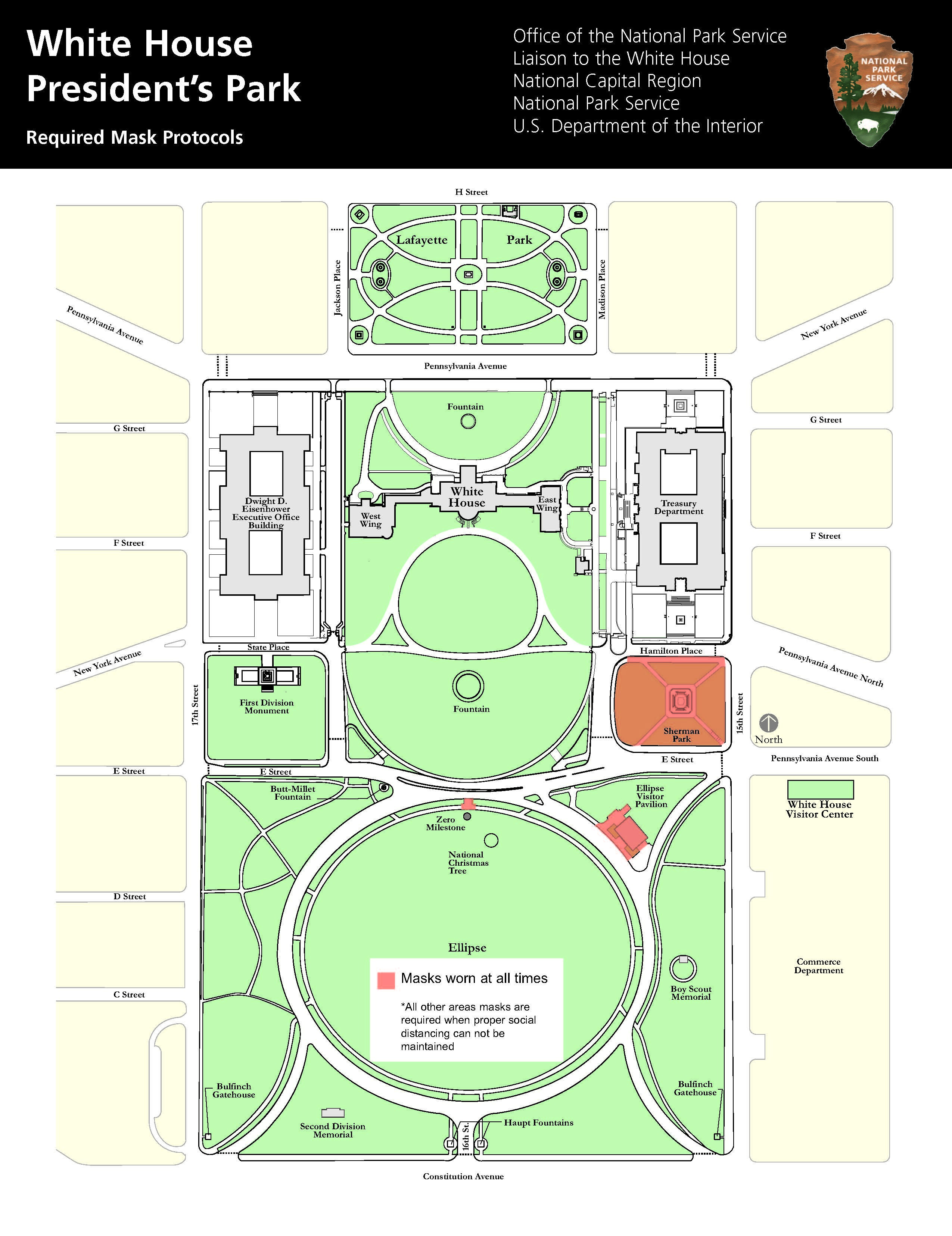
Map of President's Park with Sherman Park, Zero Milestone Marker, and Ellipse Visitor Pavilion areas highlighted in red.
Map of President's Park that notes outdoor areas where masks must be worn.
Permission must be secured from the individual copyright owners to reproduce any copyrighted materials contained within this website. Digital assets without any copyright restrictions are public domain.
NPS
Public domain:Full Granting Rights
Image
The White House and President’s Park, Code: WHHO
The White House and President’s Park, District of Columbia , District of Columbia
Latitude: 38.8969993591309, Longitude: -77.0365982055664
Latitude: 38.8969993591309, Longitude: -77.0365982055664
02/06/2021 | Map of President's Park
01/01/0001
Public Can View
Saturday, February 6, 2021 4:06:14 PM
Saturday, February 6, 2021 4:06:14 PM
WHHO PRPA Mask Use Requirements.jpg
Monday, January 1, 0001 12:00:00 AM
jpg
810.1 kB
Scenic