Select Item below to DOWNLOAD - Once item is selected, right click and choose 'save as'
26b6c565-16ab-4012-98e2-2d7b0296cd51
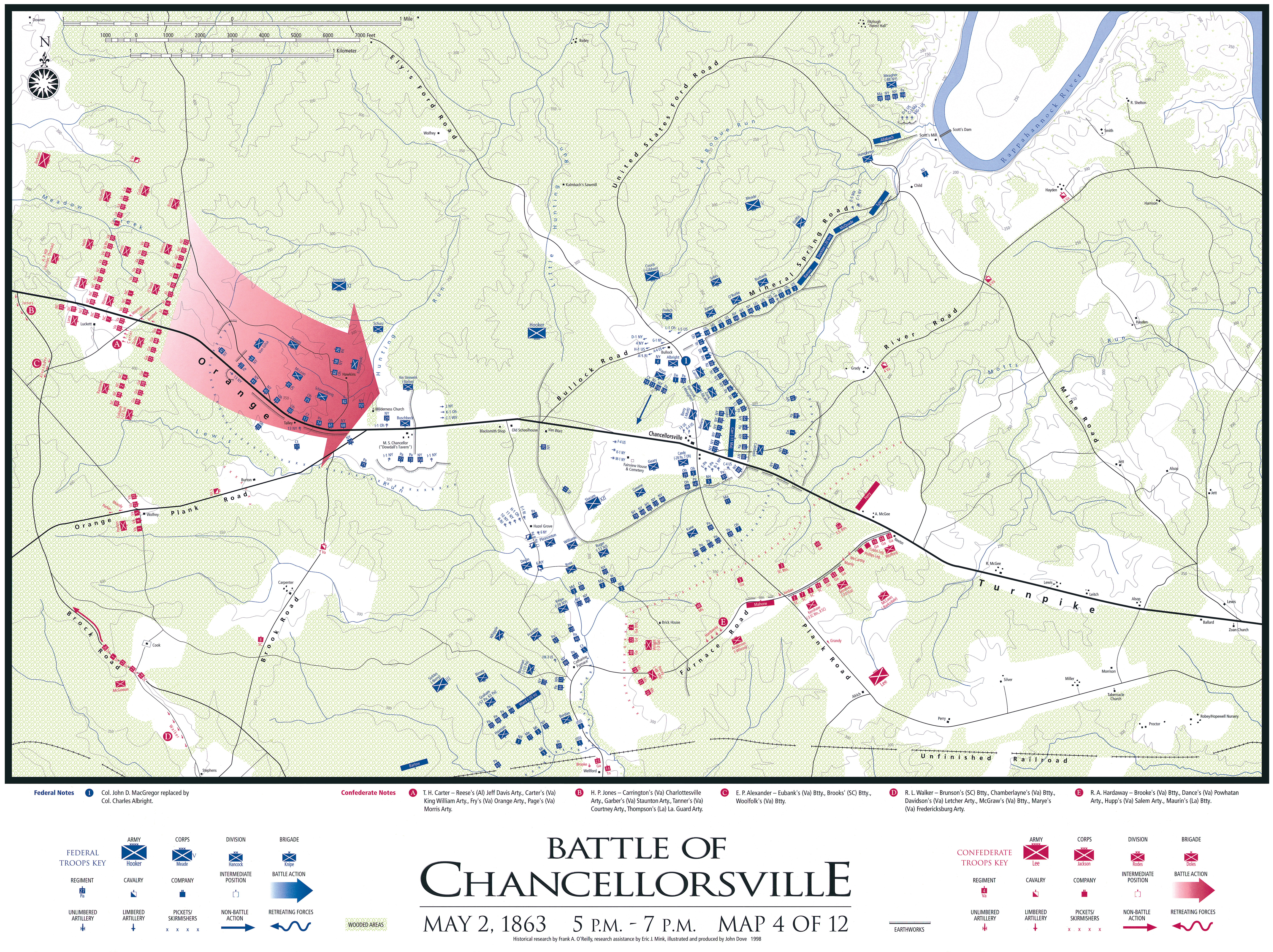
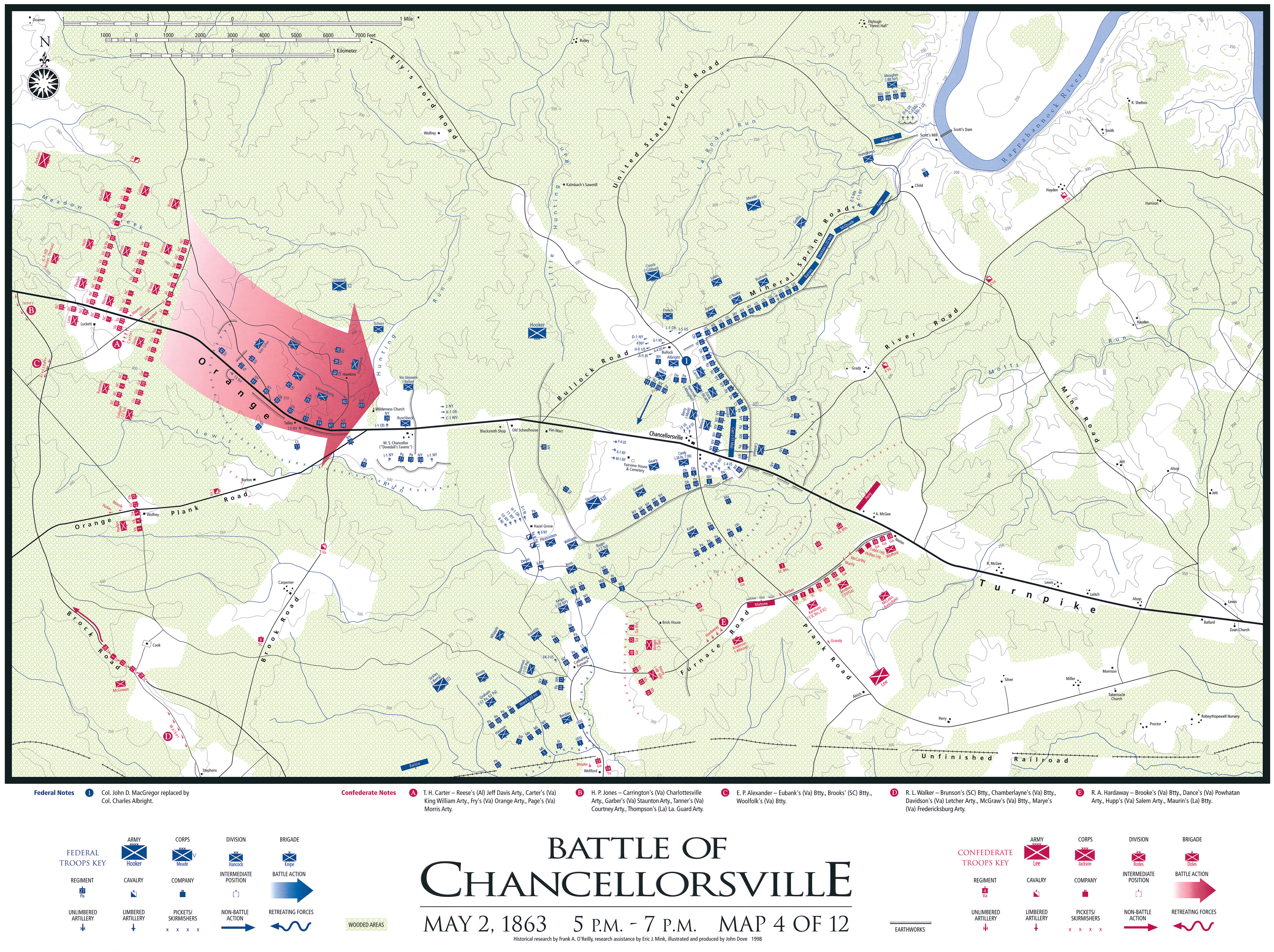
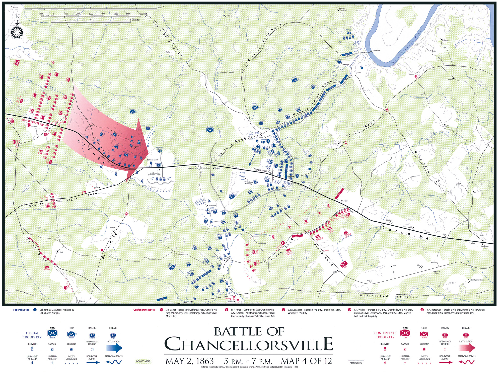
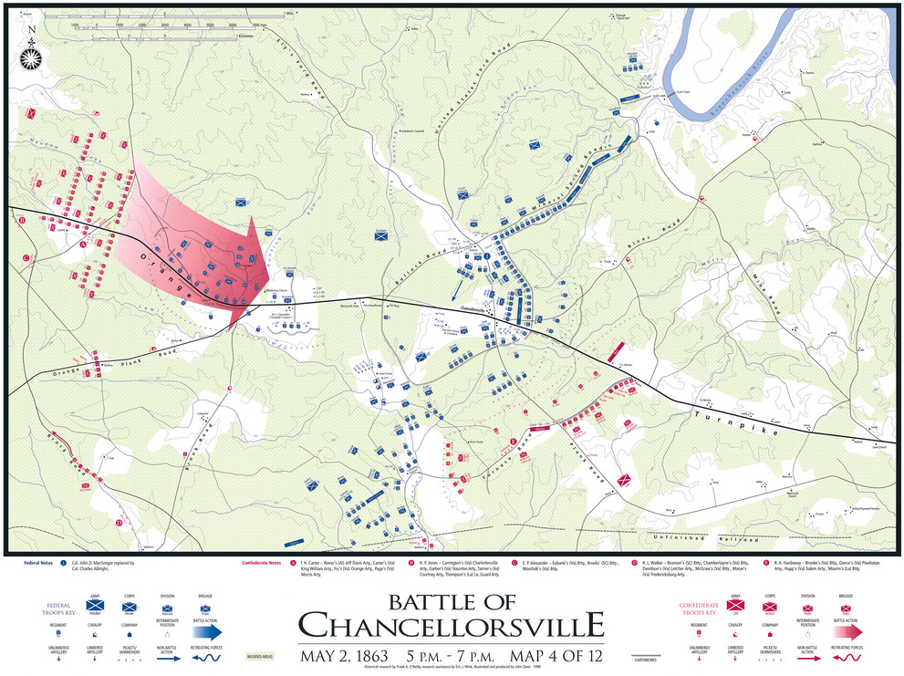
Chancellorsville Troop Movements_Map 4 of 12
A battle map showing troop movements with United States forces in blue, and Confederate in red, Confederate troops attack from the left. United States troops retreat into a cluster in the center.
Troop movement map for the Battle of Chancellorsville. May 2, 1863; 5pm-7pm.
Permission must be secured from the individual copyright owners to reproduce any copyrighted materials contained within this website. Digital assets without any copyright restrictions are public domain.
Fredericksburg and Spotsylvania NMP
Public domain:Full Granting Rights
Image
Fredericksburg and Spotsylvania National Military Park, Code: FRSP
Fredericksburg and Spotsylvania National Military Park, Virginia
Latitude: 38.2948608398438, Longitude: -77.7218475341797
Latitude: 38.2948608398438, Longitude: -77.7218475341797
01/01/0001
Public Can View
Fredericksburg and Spotsylvania NMP
Monday, November 14, 2022 7:47:17 PM
Monday, November 14, 2022 9:31:20 PM
Chancellorsville Troop Movements_Map 4 of 12.jpg
Monday, January 1, 0001 12:00:00 AM
jpg
19.7 MB
Scenic