Select Item below to DOWNLOAD - Once item is selected, right click and choose 'save as'
24cbcab6-9b80-41b0-821a-451bcfc5261b
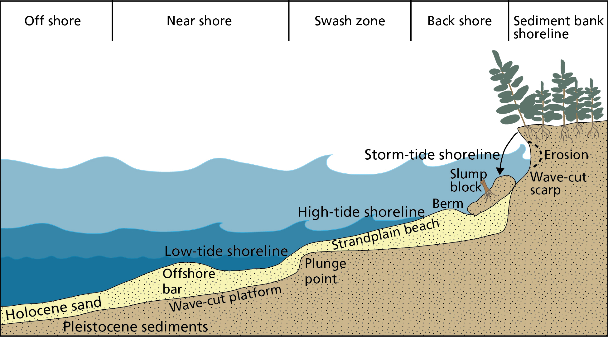
Strandplain Beach
Schematic cross section of a strandplain beach. Cross section shows features and processes off shore, near shore, in the swash zone, back shore, and sediment bank shoreline areas.
Schematic cross section of a strandplain beach. Strandplain beaches are common shoreline types on the estuarine sides of complex barrier islands. Coastal erosion occurs by direct wave attack during high astronomical, wind, and storm tides and provides a major source of sand sediment for an adjacent strandplain beach. As the sediment banks are undercut, slump blocks collapse onto the beach, where they are reworked by wave energy.
Permission must be secured from the individual copyright owners to reproduce any copyrighted materials contained within this website. Digital assets without any copyright restrictions are public domain.
Graphic redrafted by Trista Thornberry-Ehrlich (Colorado State University) after figure 4-2-1 in Riggs and Ames (2003).
Public domain:Full Granting Rights
Image
Cape Lookout National Seashore, Code: CALO
Cape Lookout National Seashore, Carteret County, North Carolina
Latitude: 34.9581985473633, Longitude: -76.1900024414063
Latitude: 34.9581985473633, Longitude: -76.1900024414063
01/01/0001
Public Can View
Thursday, August 5, 2021 10:43:41 AM
Thursday, August 5, 2021 1:02:23 PM
05_CALO-CAHA_shoreline-erosion-01.jpg
Monday, January 1, 0001 12:00:00 AM
jpg
987.6 kB
Scenic