Select Item below to DOWNLOAD - Once item is selected, right click and choose 'save as'
24939ae1-b0bf-4d44-80e6-af1f3815762c
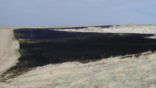
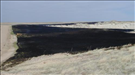
Roadside Prescribed Fire, Badlands National Park, April 25, 2002
The Roadside Burn Unit is located on both sides of the Badlands Loop Road (Highway 240) which runs 28 miles through the park from the Pinnacles Entrance, south of Wall, to the Northeast Entrance, south of Cactus Flat. The primary goals for the burn were to attempt to reduce non-native grass species (primarily smooth brome) and to increase the vigor of native species through the infusion of nutrients following the burn.
The area burned was generally between the road (at left) and the badlands features (at right)
National Park Service
Permission must be secured from the individual copyright owners to reproduce any copyrighted materials contained within this website. Digital assets without any copyright restrictions are public domain.
Public domain
Image
Badlands National Park, Code: BADL
Fire and Aviation Management Program, Code: FIRE
Fire and Aviation Management Program, Code: FIRE
Badlands National Park, South Dakota
Latitude: 43.8339996337891, Longitude: -102.393898010254
Latitude: 43.8339996337891, Longitude: -102.393898010254
Legacy NPS Focus Record ID : 231337
09/25/2003
04/25/2002
Digital image (JPG ; 31.3 KB ; 500 x 375; 300 dpi; 24 bit color). Encoded as MrSID format
Public Can View
Wednesday, September 29, 2004 6:26:03 PM
Wednesday, August 9, 2017 2:44:36 PM
badl-roadsiderx-2003_2b.jpg
Monday, January 1, 0001 12:00:00 AM
jpg
22.9 kB
Events