Select Item below to DOWNLOAD - Once item is selected, right click and choose 'save as'
23d33192-87d6-459c-8640-286593041a31
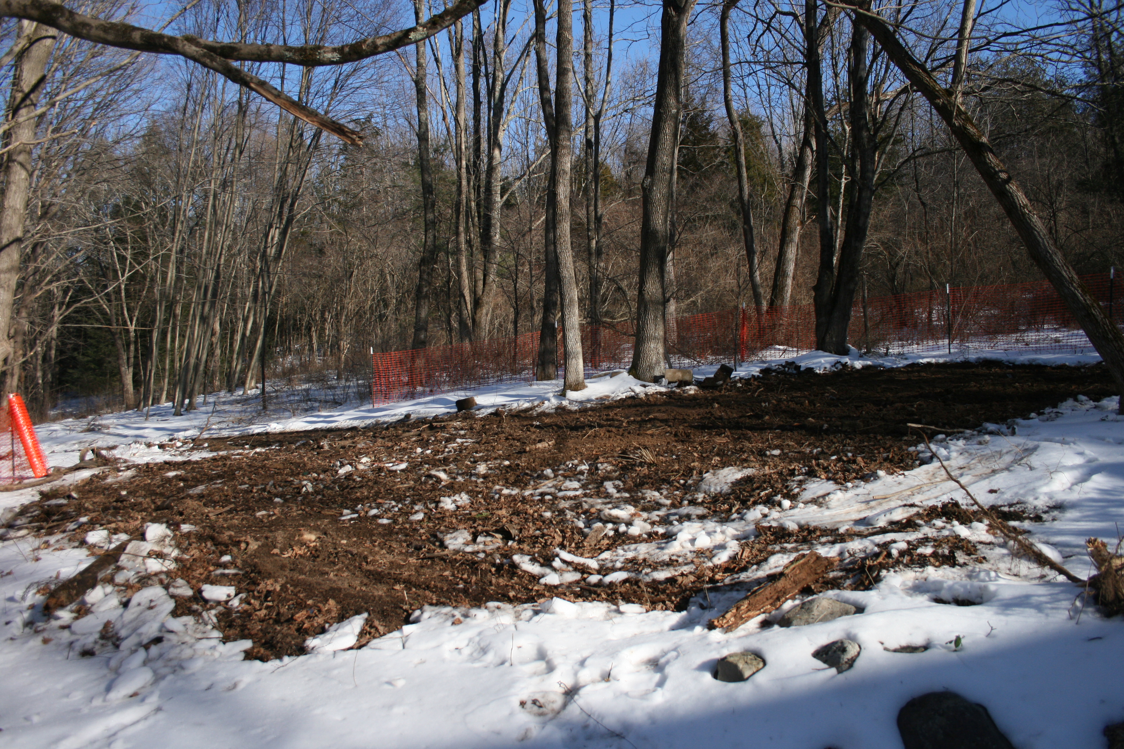
Hamilton/Minard House during demolition --- Winter 2013
Photo shows Hamilton-Minard house and outbuildings during demolition during the winter of 2012-2013.
Hamilton-Minard ground disturbance
Permission must be secured from the individual copyright owners to reproduce any copyrighted materials contained within this website. Digital assets without any copyright restrictions are public domain.
Public domain
Image
Delaware Water Gap National Recreation Area, Code: DEWA
Southeast Archeological Center, Code: SEAC
Southeast Archeological Center, Code: SEAC
Delaware Water Gap National Recreation Area
Latitude: 41.1003189086914, Longitude: -74.9569320678711
Latitude: 41.1003189086914, Longitude: -74.9569320678711
01/07/2013
01/07/2013
Image
Public Can View
Wednesday, February 13, 2013 1:51:45 PM
Wednesday, August 9, 2017 2:37:21 PM
DEWA-6d14b57805d94ecdb83da570aa0d7ffb.jpg
Canon Canon, Canon EOS DIGITAL REBEL XTi
1/1600 sec at f / 5
18 mm
ISO 400
Monday, January 7, 2013 10:02:58 PM
jpg
6.0 MB
Budget