Select Item below to DOWNLOAD - Once item is selected, right click and choose 'save as'
22b09396-b098-4278-b9ba-35e196479f0f
CAVE7356_box02_pg02.tif
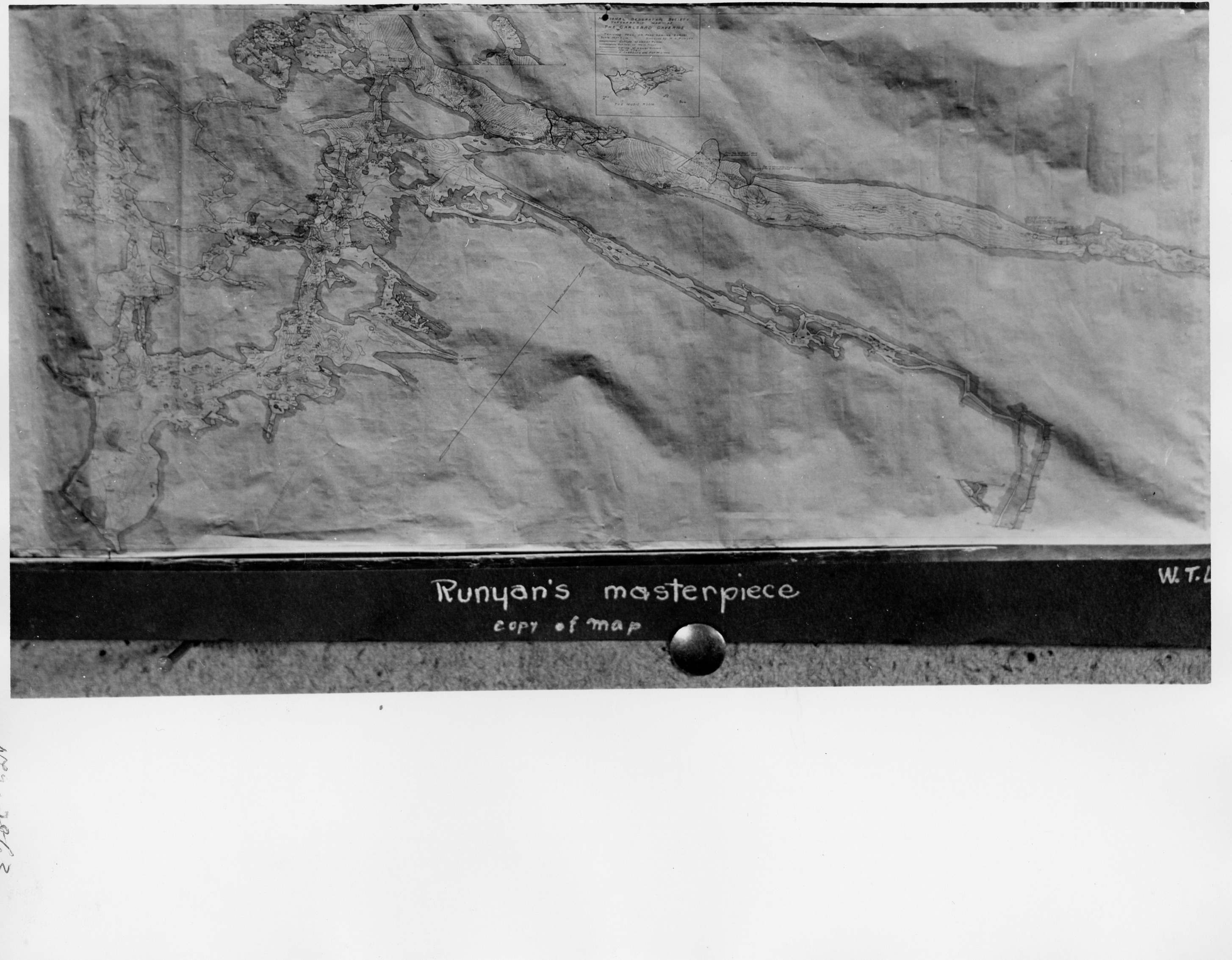
A black and white photograph of "Runyan's Masterpiece" a map of the cavern drawn by Russell Runyan as a result of the National Geographic expedition. The photo seems to show the large scale of the map.
"Runyan's Masterpiece", map of cavern drawn by Russell Runyan as a result of the National Geographic expedition.
Permission must be secured from the individual copyright owners to reproduce any copyrighted materials contained within this website. Digital assets without any copyright restrictions are public domain.
Unknown
Public domain
Image
Carlsbad Caverns National Park, Code: CAVE
Carlsbad Caverns National Park, Eddy County, New Mexico
Latitude: 32.1408996582031, Longitude: -104.553001403809
Latitude: 32.1408996582031, Longitude: -104.553001403809
11/05/2020
1924
Public Can View
Person: Hunter Carroll
Organization: Carlsbad Caverns National Park
Role: Archives Technician
Position: GS-7
Address: 3225 National Parks Highway Carlsbad New Mexico 88220
Email: hunter_carroll@nps.gov
Organization: Carlsbad Caverns National Park
Role: Archives Technician
Position: GS-7
Address: 3225 National Parks Highway Carlsbad New Mexico 88220
Email: hunter_carroll@nps.gov
Thursday, June 13, 2024 4:53:07 PM
Monday, July 1, 2024 2:29:08 PM
CAVE7356_box02_pg02.tif
Monday, January 1, 0001 12:00:00 AM
tif
2.6 MB
Historic
,
Map