Select Item below to DOWNLOAD - Once item is selected, right click and choose 'save as'
1fe00ccc-04ce-4cc9-9cdf-8b105d979f02
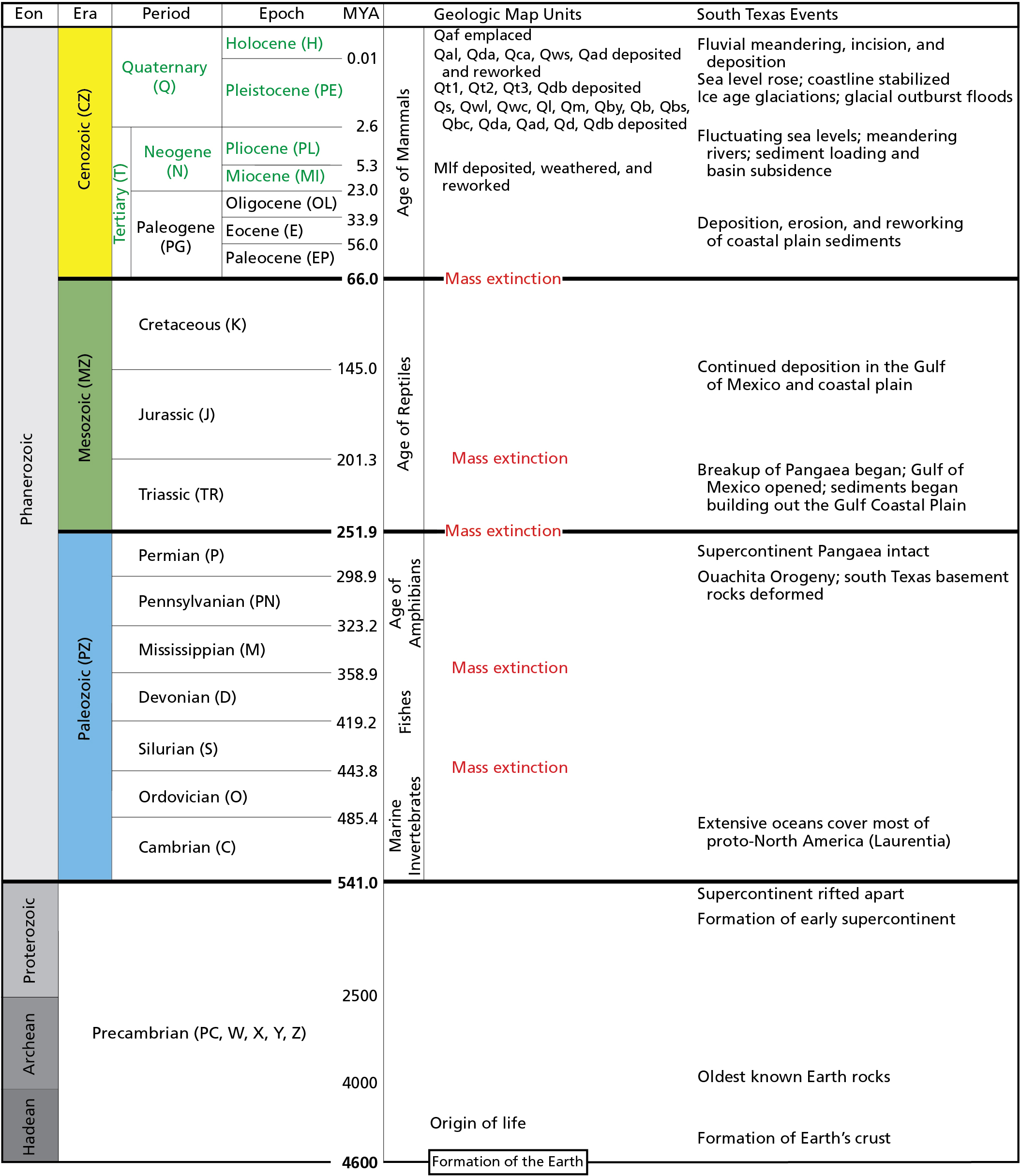
Geologic Time Scale
The time scale identifies eons, eras, periods, and epochs of geologic time ranging from the formation of the earth (4.6 billion years ago) to the current Holocene Epoch (beginning 11,700 years ago) of the Quaternary Period (beginning 2.6 million years ago) in the Cenozoic Era (beginning 66 million years ago).
The divisions of the geologic time scale are organized stratigraphically, with the oldest divisions at the bottom and the youngest at the top. GRI map abbreviations for each time division are in parentheses. Boundary ages are millions of years ago (MYA). Units mapped in the preserve are quite young and range from the Miocene through the Pleistocene and Holocene (all labelled in green).
Permission must be secured from the individual copyright owners to reproduce any copyrighted materials contained within this website. Digital assets without any copyright restrictions are public domain.
National Park Service
graphic using dates from the International Commission on Stratigraphy (http://www.stratigraphy.org/
index.php/ics-chart-timescale; accessed 7 May 2015).
Public domain:Full Granting Rights
Image
Big Thicket National Preserve, Code: BITH
Big Thicket National Preserve, Texas
Latitude: 30.1642608642578, Longitude: -94.3181228637695
Latitude: 30.1642608642578, Longitude: -94.3181228637695
01/01/0001
Public Can View
Tuesday, July 20, 2021 4:49:48 PM
Tuesday, July 20, 2021 5:51:45 PM
04_BITH_Geo Time Scale_0112-2017_tte-01.jpg
Monday, January 1, 0001 12:00:00 AM
jpg
917.3 kB
Scenic