Select Item below to DOWNLOAD - Once item is selected, right click and choose 'save as'
1F789DD1-1DD8-B71C-071D5DAE2F2D704E
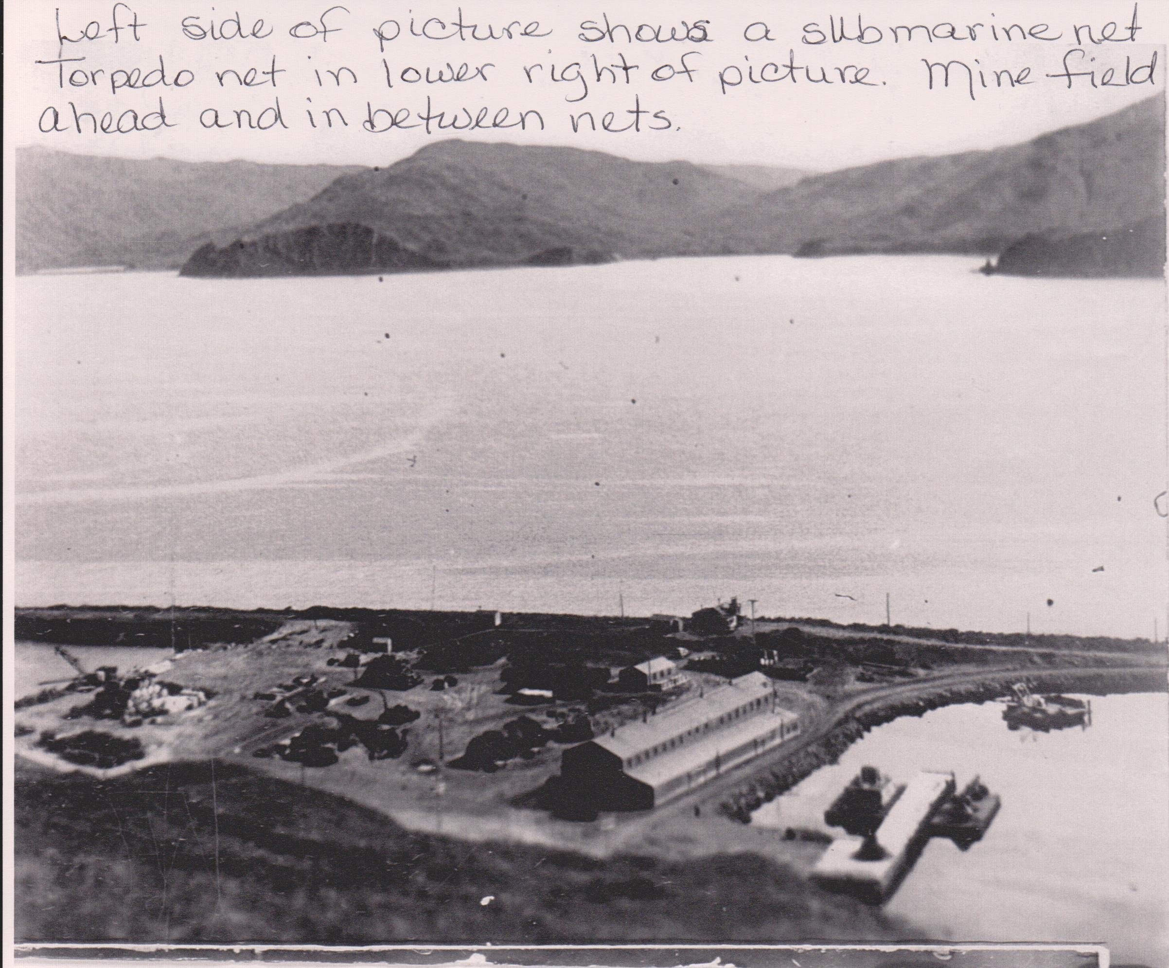
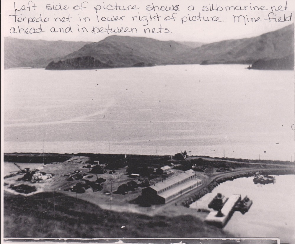
View of Dutch Harbor
View of Dutch Harbor
Left side of picture shows a submarine net. A torpedo net is in the lower right and mine field ahead and in between nets.
U.S. National Park Service
Permission must be secured from the individual copyright owners to reproduce any copyrighted materials contained within this website. Digital assets without any copyright restrictions are public domain.
Public domain:Full Granting Rights
Image
Aleutian World War II National Historic Area, Code: ALEU
Aleutian World War II National Historic Area, Aleutians West Census Area, Alaska
Latitude: 53.8943214416504, Longitude: -166.537902832031
Latitude: 53.8943214416504, Longitude: -166.537902832031
7/1/2013 3:39:17 PM
Public Can View
Friday, May 4, 2018 11:35:18 AM
Friday, May 4, 2018 11:35:18 AM
1F7998BF-1DD8-B71C-078B94FC19B8190F.jpg
Monday, January 1, 0001 12:00:00 AM
jpg
1.5 MB
Scenic
,
Historic