Select Item below to DOWNLOAD - Once item is selected, right click and choose 'save as'
The National Park Service is committed to making its electronic and information technologies accessible to individuals with disabilities.
If you require assistance or wish to report an issue related to the accessibility of any content on this website, please email NPGallery@nps.gov
If you require assistance or wish to report an issue related to the accessibility of any content on this website, please email NPGallery@nps.gov
1e3c8bd0-117a-4cac-9bab-6cd55b4f1247
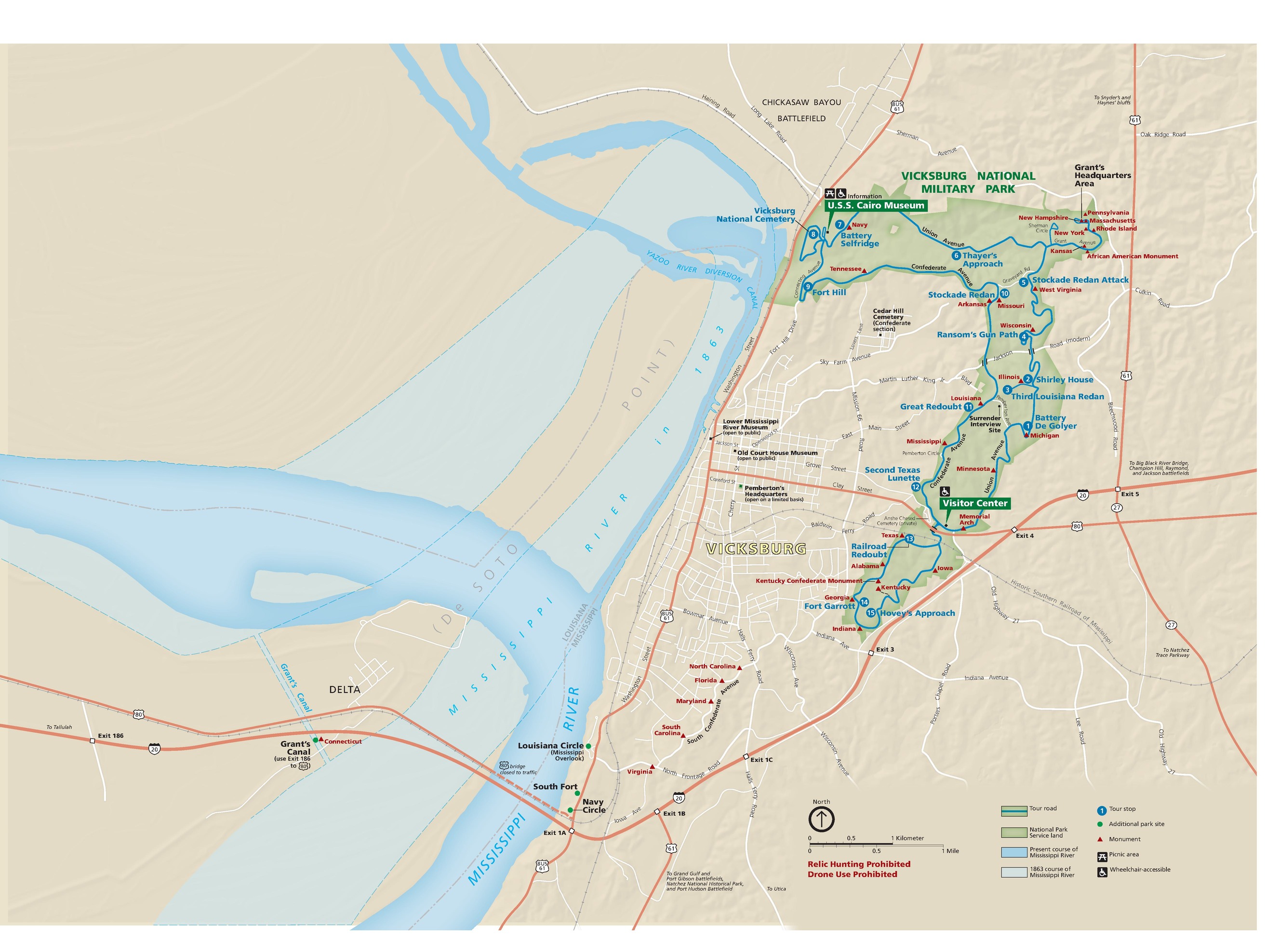
Park Map - Vicksburg National Military Park
Map of Vicksburg National Military Park in Mississippi. In the right third of the map, the apostrophe-shaped park is outlined in green. The Mississippi River is shown in blue, highways in red, local roads in white, and the terrain in beige.
Screen-viewable file; Adobe print production files can be downloaded from the Compressed zip Version link
Map Projection: WM; Map Type: park map
U.S. National Park Service
The National Park Service maps are government produced and are in the public domain. Anyone may, without restriction under U.S. copyright laws: Reproduce the work in print or digital form; Create derivative works; Perform the work publicly; Display the work; Distribute copies or digitally transfer the work to the public by sale or other transfer of ownership, or by rental, lease, or lending. Please note, a user who modifies and/or republishes National Park Service maps are responsible for any problems encountered with the maps, due to their change or modification.
Public domain
Document
Vicksburg National Military Park, Code: VICK
Vicksburg National Military Park, Warren County, Mississippi
Latitude: 32.3644981384277, Longitude: -90.8431015014648
Latitude: 32.3644981384277, Longitude: -90.8431015014648
2022-05-01
05/01/2022
Public Can View
Person: Harpers Ferry Center
Organization: US National Park Service
Address: Harpers Ferry Center, Harpers Ferry, WV
Email: HFC_Cartography@nps.gov
Organization: US National Park Service
Address: Harpers Ferry Center, Harpers Ferry, WV
Email: HFC_Cartography@nps.gov
Monday, June 5, 2023 10:21:53 PM
Friday, September 26, 2025 11:38:03 PM
VICKmap1.pdf
pdf
19.8 MB
Map