Select Item below to DOWNLOAD - Once item is selected, right click and choose 'save as'
1c53c5c9-9c87-400c-8fed-34c895f5de02
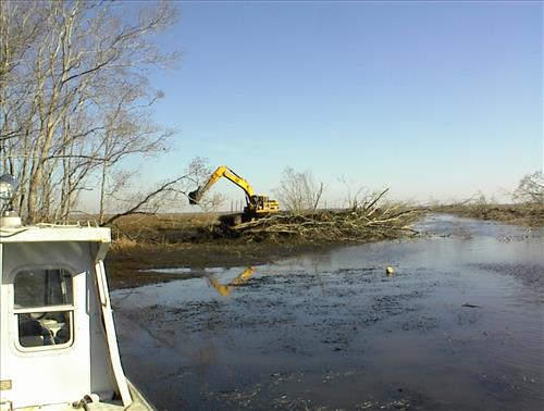
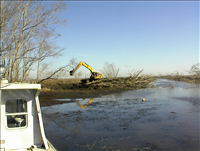
Restoration of abandoned oil and gas canal at the Barataria Preserve
Map of abandoned oil and gas canal that is situated between Lake Salvador and the Bayou Segnette Waterway.
photo of excavator degrading spoilbanks and pulling material into the canal.
Permission must be secured from the individual copyright owners to reproduce any copyrighted materials contained within this website. Digital assets without any copyright restrictions are public domain.
Public domain
Image
Jean Lafitte National Historical Park and Preserve, Code: JELA
Barataria Preserve, Jean Lafitte National Historical Park and Preserve, Jefferson Parish, Louisiana
Latitude: 29.8048000335693, Longitude: -90.118766784668
Latitude: 29.8048000335693, Longitude: -90.118766784668
Legacy NPS Focus Record ID : 238046
01/04/2002
01/01/2007
Public Can View
Tuesday, December 4, 2007 3:59:08 PM
Wednesday, August 9, 2017 1:38:37 PM
JELA-f9db4641e4c647db9586c07e798a814c.jpg
Hewlett-Packard Company
90/10000 sec at f / 11
5.9 mm
Friday, January 4, 2002 5:45:53 PM
jpg
425.5 kB
Map