Select Item below to DOWNLOAD - Once item is selected, right click and choose 'save as'
1b97b6a4-bff0-4922-bf90-fadf00366569
Image Not Available, Inspection Report Water System Map
Image Not Available, Inspection Report Water System Map
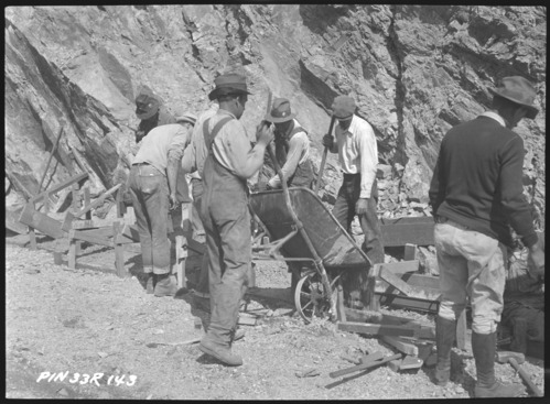
Pinnacles National Monument Inspection Report Water System Map.
U.S. National Parks Service
Oversized document, not scanned. Contact Pinnacles National Park for access. For more information on the present image, visit PINN_4372_0135 on NPGallery.
This digital asset is in the public domain. When using this asset for any purpose, including online, credit: 'Courtesy U.S. National Parks, Pinnacles National Park'
NPS
Public domain
Document
Pinnacles National Park, Code: PINN
Pinnacles National Park, California
Latitude: 36.4753494262695, Longitude: -121.173400878906
Latitude: 36.4753494262695, Longitude: -121.173400878906
Circa 1931-1946
Original ID Sanitary Systems: Water and Sewer Systems 1931-1946., 8.5 x 11 inches
Manuscript: Page 19 ; Catalog NO: 3658 ; Box NO: Box 5 ; Folder NO: 22
Public Can View
Organization: Pinnacles National Park
Address: 5000 East Entrance Rd., Paicines, CA 95043, tel: 831-389-4486
Address: 5000 East Entrance Rd., Paicines, CA 95043, tel: 831-389-4486
Monday, May 19, 2025 7:27:22 PM
Monday, May 19, 2025 7:27:22 PM
PINN_3658_1314.tif
tif
10.4 MB
Historic