Select Item below to DOWNLOAD - Once item is selected, right click and choose 'save as'
1a8ac17d-b2b3-43c0-a3d3-e0a1b5ce6490
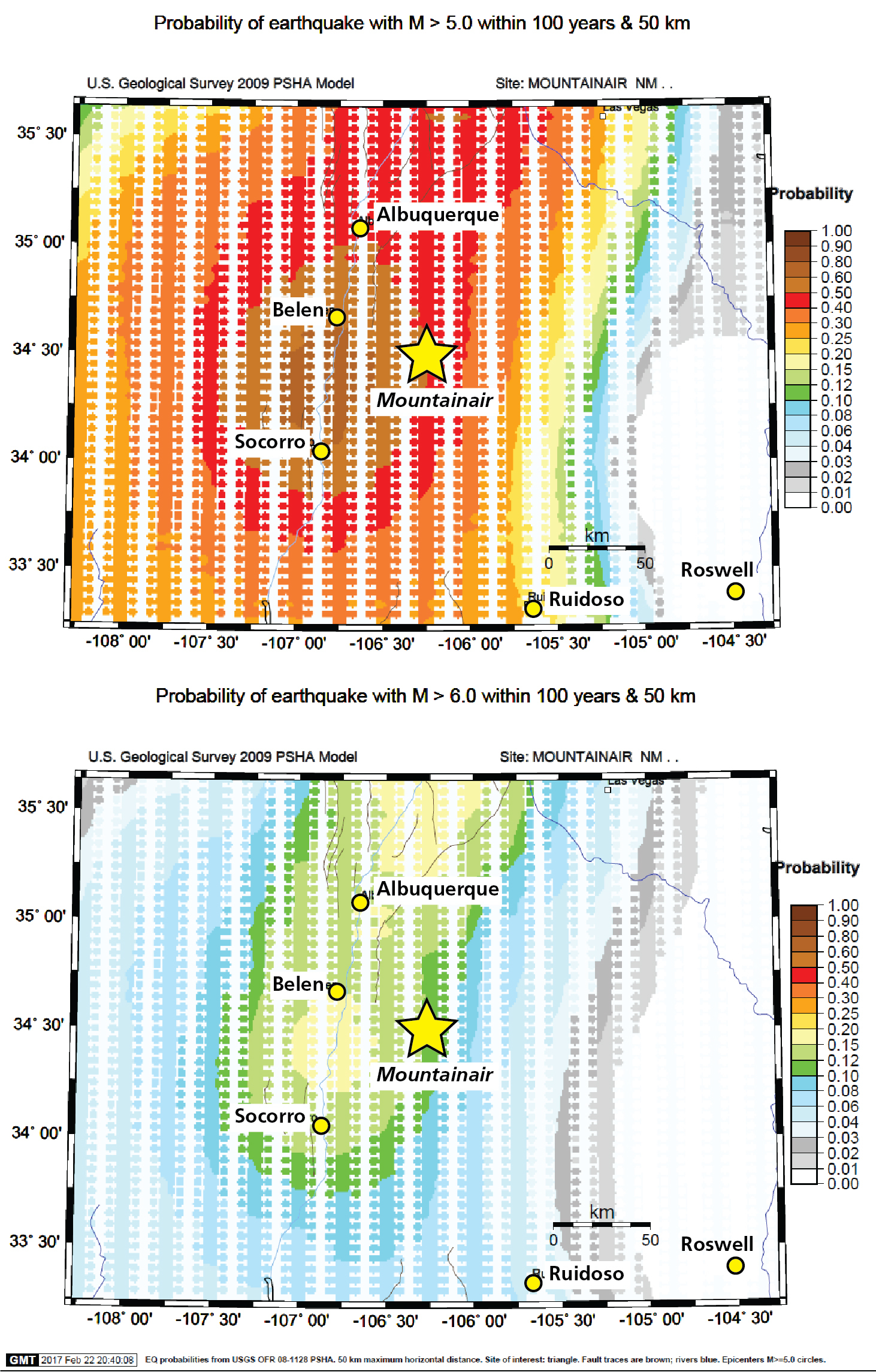
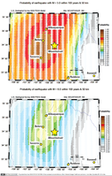
Maps of Earthquake Probability
Maps of earthquake probability. The probability of a magnitude 5.0 (or greater) earthquake in the next 100 years at Mountainair is between 0.4 and 0.5. The probability of a magnitude 6.0 (or greater) earthquake in the next 100 years at Mountainair is between 0.1 and 0.12.
These maps show the probability of earthquakes with magnitude 5.0 (top) and 6.0 (bottom) occurring in the next 100 years within 50 km (30 mi) of Mountainair, New Mexico (yellow star; other cities labelled with
yellow dots).
Permission must be secured from the individual copyright owners to reproduce any copyrighted materials contained within this website. Digital assets without any copyright restrictions are public domain.
Maps were developed using the USGS 2009 Earthquake Probability Mapping tool (as of 2017, this tool is no longer available online). The “puzzle piece” appearance is an artifact from processing the model data.
Public domain:Full Granting Rights
Image
Salinas Pueblo Missions National Monument, Code: SAPU
Salinas Pueblo Missions National Monument, New Mexico
Latitude: 34.2599182128906, Longitude: -106.092796325684
Latitude: 34.2599182128906, Longitude: -106.092796325684
01/01/0001
Public Can View
Friday, August 6, 2021 3:51:23 PM
Friday, August 6, 2021 4:24:51 PM
Figure 17_SAPU_eqprob_compiled-01.jpg
Monday, January 1, 0001 12:00:00 AM
jpg
2.5 MB
Scenic