Select Item below to DOWNLOAD - Once item is selected, right click and choose 'save as'
152759a3-3d22-4aba-8658-78d40c3ea035
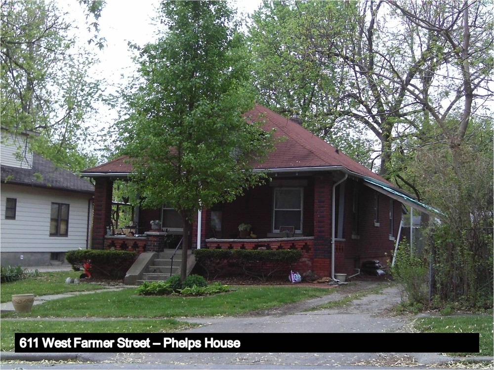
611 West Farmer Street
Image of the Bungalow-style Phelps House.
Resource 163
611 West Farmer Street (in 2011)
Classification: Contributing.
Historic Name: Phelps House.
Architectural Style: Bungalow.
Construction Date: ca. 1920.
Period 3 of Harry S Truman's Life: Developing Political Skills and Associations, 1920-1933.
Tax Identification: 26-340-22-03.
Legal Description: Zick's Addition, lot 3.
Description: Contributing one- and one-half story wood-frame dwelling; rectangular in shape; hipped roof with hipped dormer on façade, clad with composition shingles; exposed rafters; brick exterior; one-over-one double-hung sash windows; porch with square brick posts and decorative brick balustrade extends across façade; brick foundation with daylight basement. Level lot with lawn, small hedge along foundation; shade trees in side and rear yards.
• Alterations: Shed roof addition to the rear.
History/Significance: This Bungalow style house may have been built for Mahala and Wesley Phelps around 1920. They occupied the house in 1920. The Phelps couple raised four daughters and three sons. One of the three sons, Edward F. Phelps, fought in Battery C of the 129th Field Artillery (Truman was captain of Battery D, 129th Field Artillery) during World War I and was killed in the Battle of Argonne. Mahala Phelps died at home in the fall of 1923. Wesley Phelps may have remained in the house for a few more years. He died in 1935. By 1930, however, Thomas W. and Louise Rees and their family resided at 611 West Farmer Street. Tom Rees worked as a salesman at Smith Motor Company for more than twenty years. In 1936, at age forty-eight, he died unexpectedly of a heart attack while at home. Louise A. Rees remained at 611 West Farmer Street into the 1950s.
Permission must be secured from the individual copyright owners to reproduce any copyrighted materials contained within this website. Digital assets without any copyright restrictions are public domain.
NPS/Jeff Wade
Public domain:Full Granting Rights
Image
Harry S. Truman National Historic Site, Code: HSTR
611 West Farmer Street, Independence, Harry S. Truman National Historic Site, Jackson County, Missouri
Latitude: 38.9012985229492, Longitude: -94.5307006835938
Latitude: 38.9012985229492, Longitude: -94.5307006835938
05/01/2011 | Date is approximate. All photographs were taken during May 2011.
01/01/0001
Public Can View
Friday, September 17, 2021 10:54:16 AM
Saturday, September 18, 2021 11:41:08 AM
_163 611 West Farmer Street.jpg
Monday, January 1, 0001 12:00:00 AM
jpg
342.3 kB
Scenic