Select Item below to DOWNLOAD - Once item is selected, right click and choose 'save as'
1524d455-92ca-4500-9e39-59f252fdb838
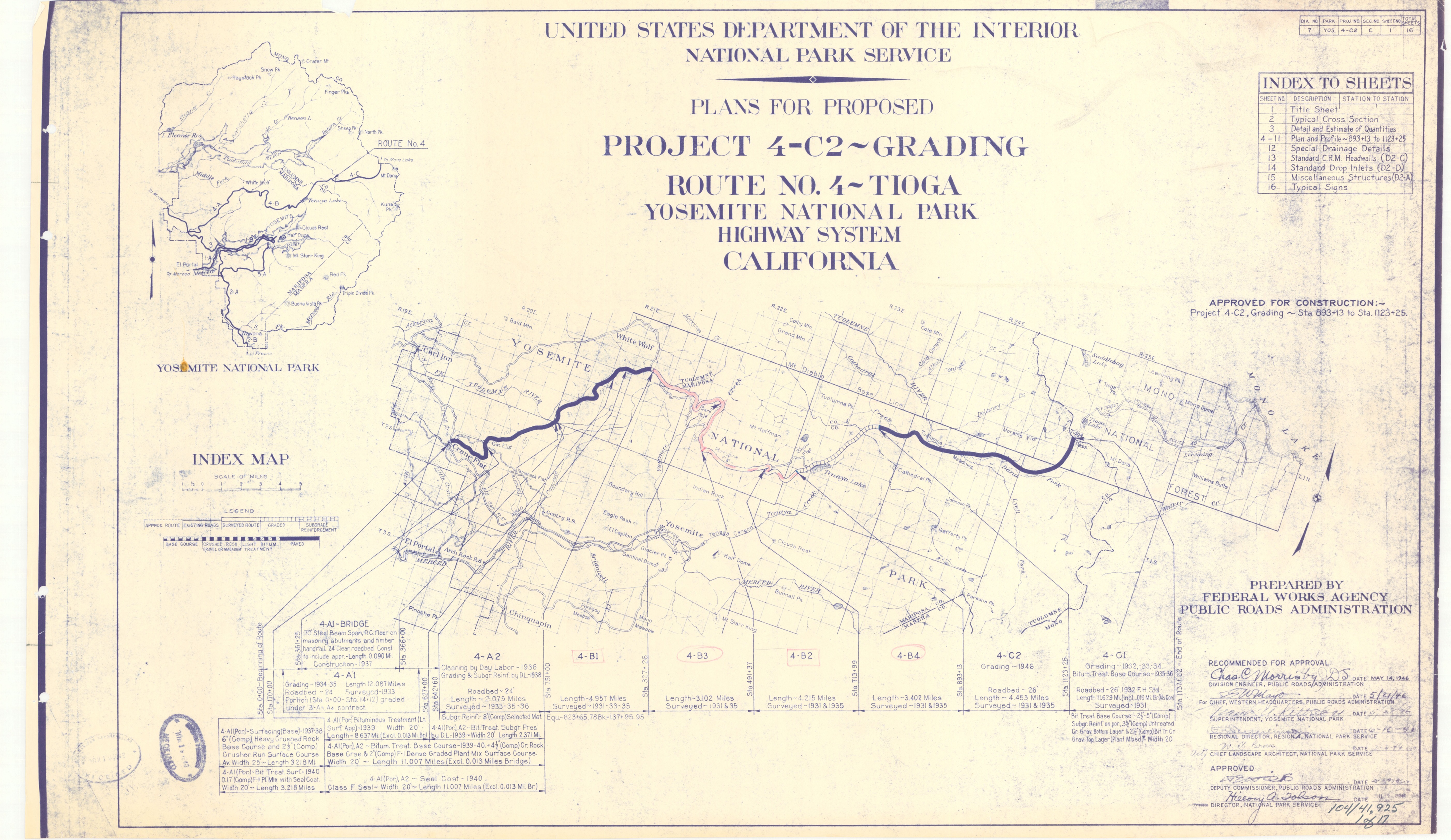
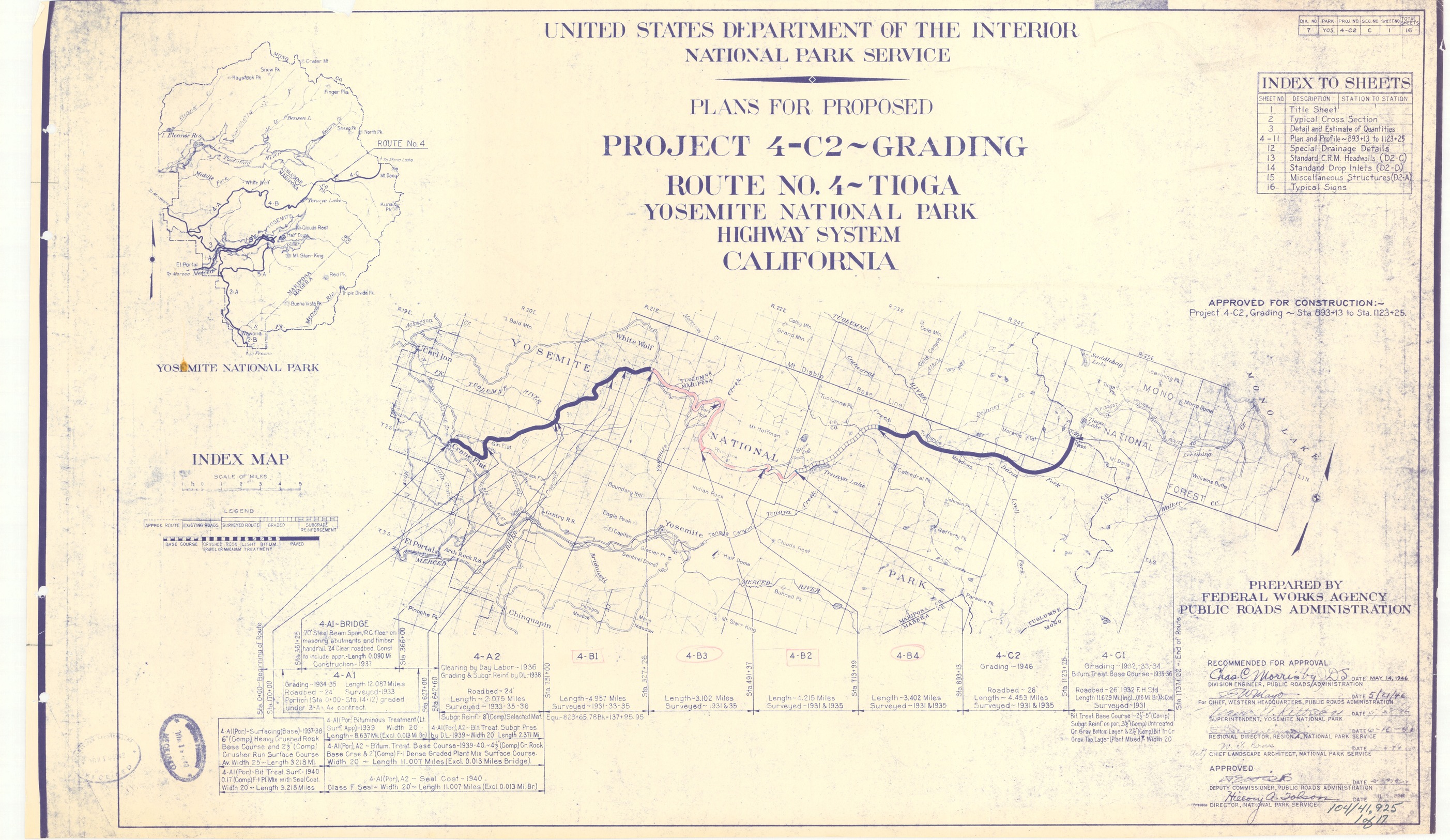
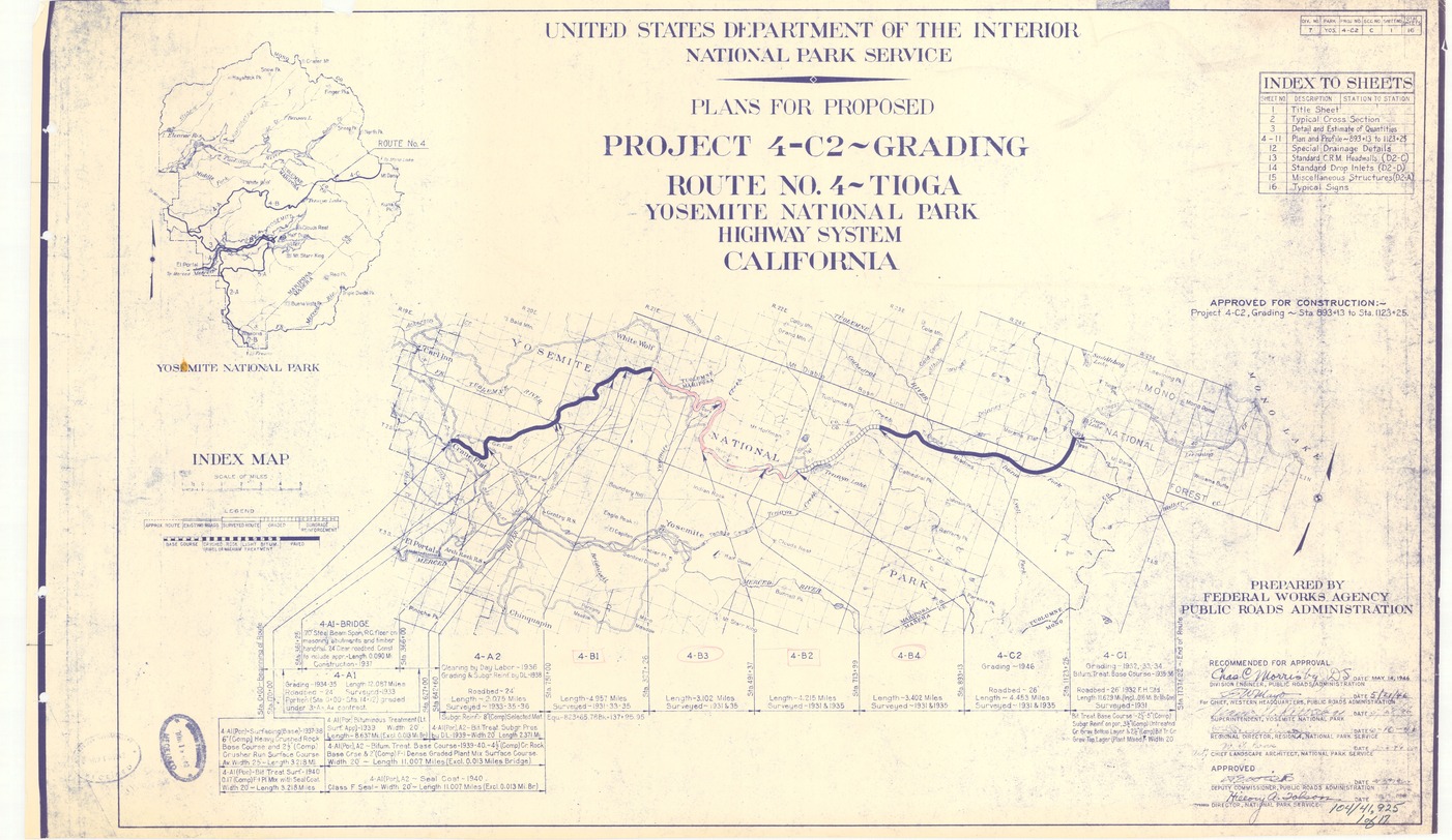
Plans for Proposed Project 4-C2 ~ Grading Route No. 4 ~ Tioga Yosemite National Park Highway System
Plans for Proposed Project 4-C2 ~ Grading Route No. 4 ~ Tioga Yosemite National Park Highway System
Index map of yosemite with roadway details
Item Number: YOSEAR000486A; TIC No: 104/41,925; Alternate Id: 1 of 17, 4-C2
Contact Yosemite National Park for more copyright information and use
Public domain:This digital asset is in the public domain. When using this asset for any purpose, including online, credit:'Courtesy U.S. National Parks'
41925, (YOSE TIC Number)
Image
Yosemite National Park, Code: YOSE
Yosemite National Park, California
Latitude: 37.8399200439453, Longitude: -119.540397644043
Latitude: 37.8399200439453, Longitude: -119.540397644043
07011946
07011946
Type: paper; Dimensions: 22.5 X 36; Condition: good
YOSE Location: E1 DR15 F4
Public Can View
Person: Archivist
Organization: US National Park Service
Address: Yosemite National Park Archives, PO Box 700-W, El Portal, CA 95318
Email: yose_archives@nps.gov
Organization: US National Park Service
Address: Yosemite National Park Archives, PO Box 700-W, El Portal, CA 95318
Email: yose_archives@nps.gov
Tuesday, July 26, 2022 4:58:49 PM
Tuesday, July 26, 2022 4:58:49 PM
YOSEAR000486A.tif
tif
124.9 MB
Scenic
,
Map