Select Item below to DOWNLOAD - Once item is selected, right click and choose 'save as'
132ea4e6-d44e-4b39-8b10-b0736881a693
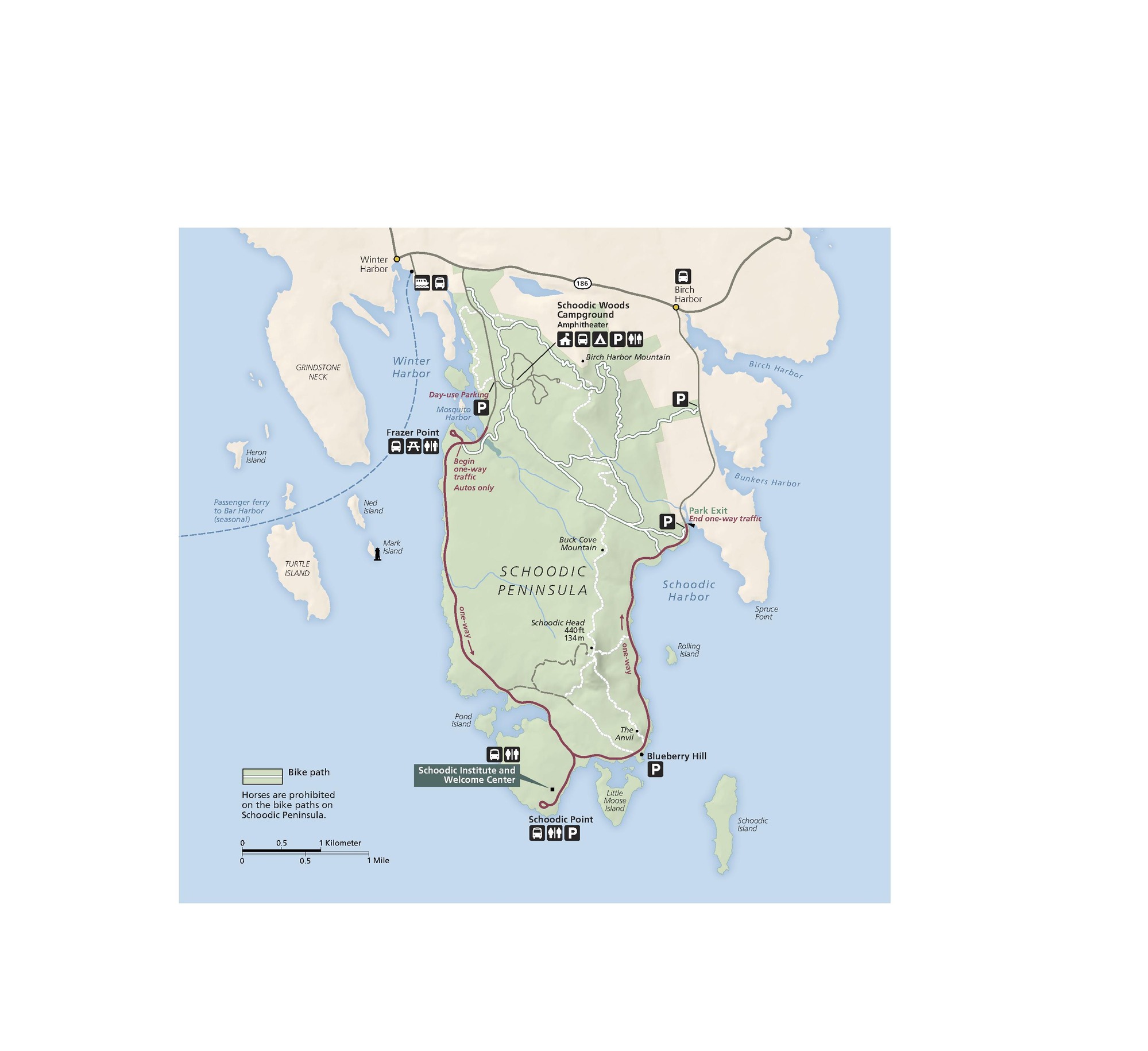
Schoodic Peninsula Map - Acadia National Park
Map of Schoodic Peninsula and Acadia National Park in Maine. The roughly rectangular peninsula is shaded green for parkland, and surrounding land is beige. A road runs horizontally above the park and dips down, connecting with a U-shaped red road that follows the coastal perimeter.
Screen-viewable file; Adobe print production files can be downloaded from the Compressed zip Version link
Map Projection: WM; Map Type: detail
U.S. National Park Service
The National Park Service maps are government produced and are in the public domain. Anyone may, without restriction under U.S. copyright laws: Reproduce the work in print or digital form; Create derivative works; Perform the work publicly; Display the work; Distribute copies or digitally transfer the work to the public by sale or other transfer of ownership, or by rental, lease, or lending. Please note, a user who modifies and/or republishes National Park Service maps are responsible for any problems encountered with the maps, due to their change or modification.
Public domain
Document
Acadia National Park, Code: ACAD
Acadia National Park, Maine
Latitude: 44.3593788146973, Longitude: -68.2397308349609
Latitude: 44.3593788146973, Longitude: -68.2397308349609
2021-05-20
Public Can View
Person: Harpers Ferry Center
Organization: US National Park Service
Address: Harpers Ferry Center, Harpers Ferry, WV
Email: HFC_Cartography@nps.gov
Organization: US National Park Service
Address: Harpers Ferry Center, Harpers Ferry, WV
Email: HFC_Cartography@nps.gov
Friday, April 22, 2022 5:32:57 PM
Friday, September 26, 2025 11:33:50 PM
ACADmap4.pdf
pdf
1.8 MB
Map