Select Item below to DOWNLOAD - Once item is selected, right click and choose 'save as'
11eb8f34-73f7-4070-9590-b733a3e1acf6
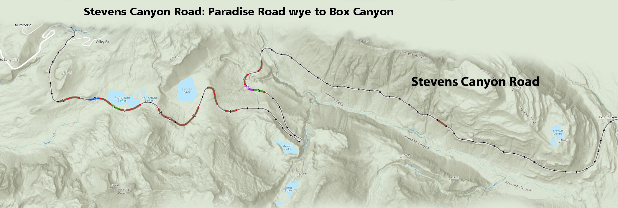
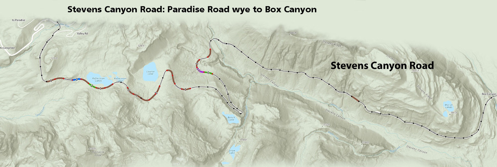
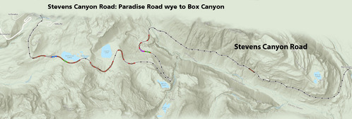
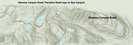
Mapping Amphibians: Stevens Canyon to Box Canyon
A map of a road broken into 0.1 mile road segments with color shading and numbers indicating the number of amphibians observed in each segment.
Number of amphibians observed per 0.1 mile road segment along Stevens Canyon Road from the Paradise Road wye to Box Canyon.
Permission must be secured from the individual copyright owners to reproduce any copyrighted materials contained within this website. Digital assets without any copyright restrictions are public domain.
NPS Graphic
Public domain:Full Granting Rights
Image
Mount Rainier National Park, Code: MORA
Mount Rainier National Park, Washington
Latitude: 46.865608215332, Longitude: -121.682601928711
Latitude: 46.865608215332, Longitude: -121.682601928711
10/25/2021
10/25/2021
Public Can View
Wednesday, October 27, 2021 11:05:40 AM
Wednesday, October 27, 2021 11:15:16 AM
Stevens Canyon to Box_edit1.jpg
Monday, October 25, 2021 5:15:54 PM
jpg
362.0 kB
Scenic