Select Item below to DOWNLOAD - Once item is selected, right click and choose 'save as'
10f0a1ba-d955-44d5-9294-d0c7ad4950bc
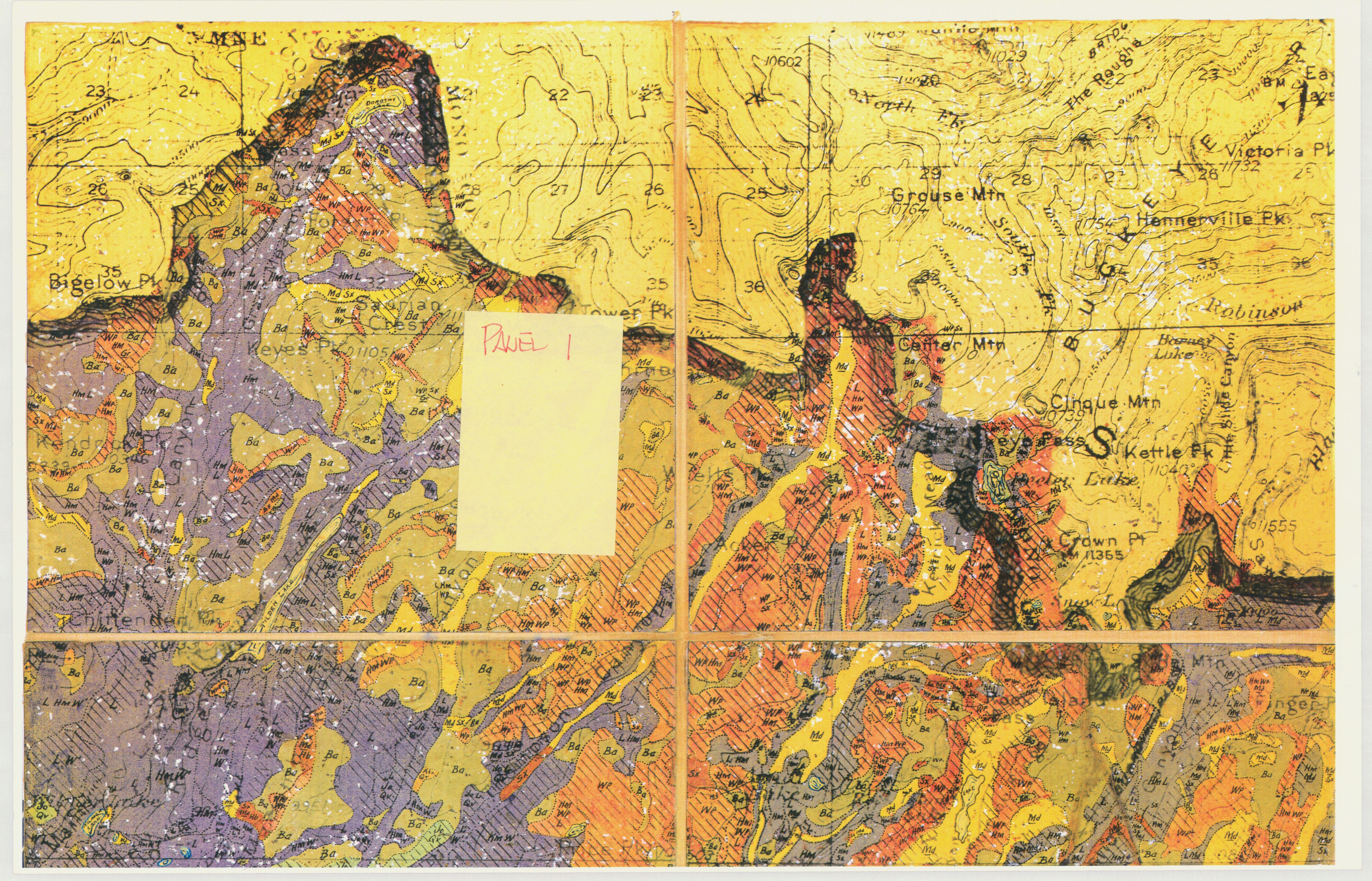
Wieslander 1930s Yosemite National Park Vegetation Map Photo Copy - Panel 1
Wieslander 1930s Yosemite National Park Vegetation Map Photo Copy - Panel 1
Photo copy of vegetation map panel 1
Item Number: YOSEAR000787K
Contact Yosemite National Park for more copyright information and use
Public domain:This digital asset is in the public domain. When using this asset for any purpose, including online, credit:'Courtesy U.S. National Parks'
Image
Yosemite National Park, Code: YOSE
Yosemite National Park, California
Latitude: 37.8399200439453, Longitude: -119.540397644043
Latitude: 37.8399200439453, Longitude: -119.540397644043
Undated
Type: paper; Dimensions: 11 x 17; Condition: good
YOSE Location: E2 DR8 F1
Public Can View
Person: Archivist
Organization: US National Park Service
Address: Yosemite National Park Archives, PO Box 700-W, El Portal, CA 95318
Email: yose_archives@nps.gov
Organization: US National Park Service
Address: Yosemite National Park Archives, PO Box 700-W, El Portal, CA 95318
Email: yose_archives@nps.gov
Monday, July 25, 2022 9:27:23 PM
Monday, July 25, 2022 9:27:23 PM
YOSEAR000787K.tif
tif
54.9 MB
Scenic
,
Map