Select Item below to DOWNLOAD - Once item is selected, right click and choose 'save as'
108a6d0fc54e4fbd921cf1c3ad4cf7f6
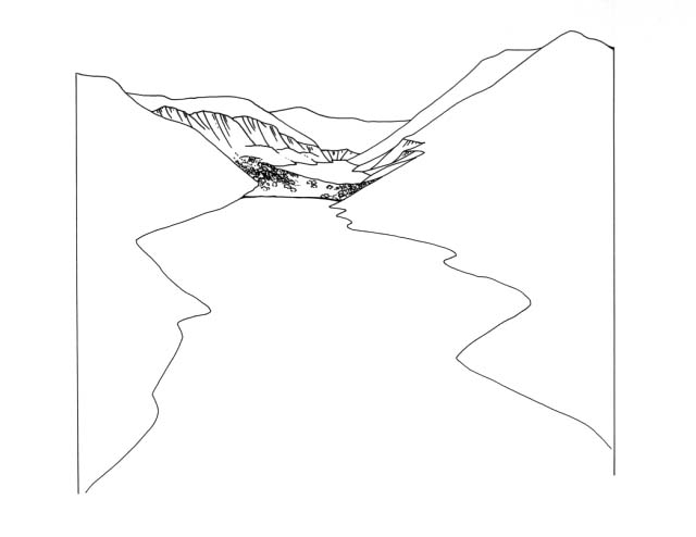
Diagram shows the landslide which divides Lake Crecent from Lake Sutherland in Olympic National Park.
Diagram shows the landslide which divides Lake Crecent from Lake Sutherland in Olympic National Park.
Abbr=WE
U.S. National Park Service
Reflective Art
Government owns art and all reproduction rights.
Public domain
Image
Olympic National Park, Code: OLYM
Olympic National Park, Washington
Latitude: 47.7885704040527, Longitude: -123.699600219727
Latitude: 47.7885704040527, Longitude: -123.699600219727
Image Management System : IMS 08976
20190904
01/01/1980 - 12/30/1989
Image_Size=10" x 9"; Exhibit 56/Graphic # 56-4
O 5
Public Can View
Organization: Harpers Ferry Center
Address: Harpers Ferry Center, 67 Mather Place, Harpers Ferry, WV, 25425, 304-535-5050
Address: Harpers Ferry Center, 67 Mather Place, Harpers Ferry, WV, 25425, 304-535-5050
Friday, October 4, 2019 12:56:30 PM
Friday, October 4, 2019 12:56:30 PM
08976.jpg
jpg
22.1 kB
Museum