Select Item below to DOWNLOAD - Once item is selected, right click and choose 'save as'
0dbb4936-758d-49d9-8500-2dbdeccf7c20
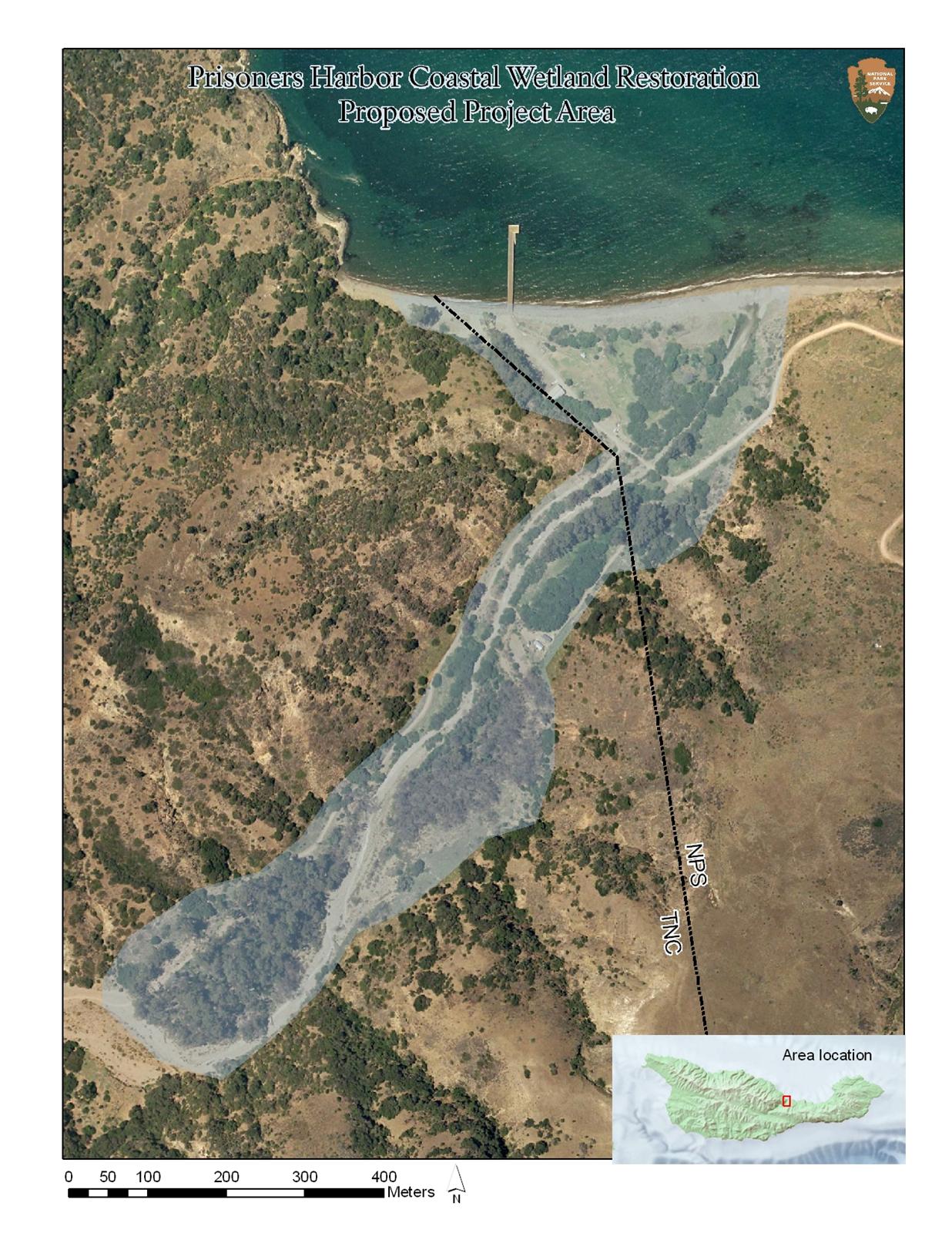
Map of proposed Project Area for Prisoners Harbor Wetland Restoration on Santa Cruz Island.
Proposed Project Area for Prisoners Harbor Wetland Restoration. Channel Islands National Park proposes to restore ecosystem function to the disturbed coastal wetland at Prisoners Harbor and the riparian corridor in the lower Canada del Puerto.
Proposed Project Area for Prisoners Harbor Wetland Restoration. Channel Islands National Park proposes to restore ecosystem function to the disturbed coastal wetland at Prisoners Harbor and the riparian corridor in the lower Canada del Puerto..
Permission must be secured from the individual copyright owners to reproduce any copyrighted materials contained within this website. Digital assets without any copyright restrictions are public domain.
Public domain:Full Granting Rights
Image
Channel Islands National Park, Code: CHIS
Channel Islands National Park - Santa Cruz Island - Prisoners Harbor, Channel Islands National Park, California
Latitude: 34.0039100646973, Longitude: -119.725196838379
Latitude: 34.0039100646973, Longitude: -119.725196838379
10/03/2004
01/01/2008
Public Can View
Organization: Channel Islands National Park
Address: 1901 Spinnaker Drive
Address: 1901 Spinnaker Drive
Tuesday, February 17, 2009 2:29:57 PM
Friday, November 20, 2020 2:20:59 PM
CHIS-c16bd2c83be24e23a7a8eeaac0f4c837.jpg
Monday, January 1, 0001 12:00:00 AM
jpg
357.2 kB
Map
,
Budget