Select Item below to DOWNLOAD - Once item is selected, right click and choose 'save as'
0b96af8d-4dc6-44ed-9ba5-bfab32b72a5f
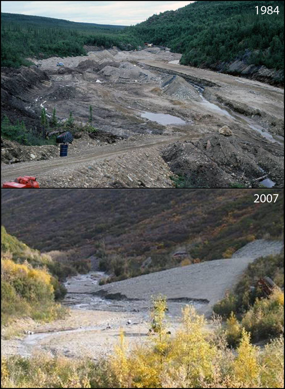
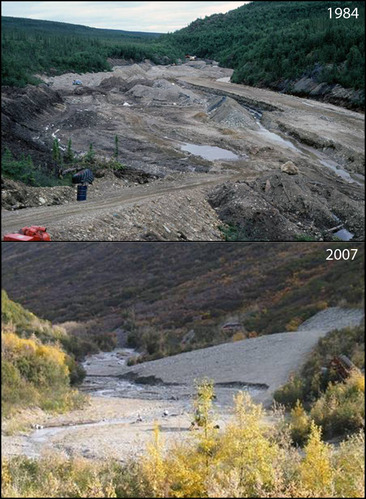
Human Development and Impacts at Kantishna Hills: 1984-2007
A photo pair showing Human Development and Impacts at Kantishna Hills: 1984-2007
What a difference a couple of decades and a reclamation project can make! This photo pair shows two views of Glen Creek, a stream that was disastrously altered by placer mining in the decades prior to 1984 (which is obvious from the early photo). National Park Service reclamation projects restored the landscape in this area and allowed both natural and artificial revegetation work to bring the site back from a devastated condition to being (at least in appearance) a relatively normal stream.
Original year: 1984; Rephoto year: 2007
U.S. National Park Service
Photos and photo pairs are pre-approved for educational use ONLY. To use them in educational products, credit them the same way as they are credited on the website, Photo Credit: Original photographer: Weiler; Rephoto photographer: Technical aerial photo (USGS). For any other use beyond education, contact Denali National Park and Preserve for additional copyright information on specific images of interest.
Original photographer: Weiler; Rephoto photographer: Technical aerial photo (USGS)
Restrictions apply on use and/or reproduction
Image
Denali National Park and Preserve, Code: DENA
Kantishna Hills, Alaska Range mountains, Alaska
Latitude: 63.549341, Longitude: -150.726902
Denali National Park and Preserve, Alaska
Latitude: 63.3182792663574, Longitude: -150.602905273438
Latitude: 63.549341, Longitude: -150.726902
Denali National Park and Preserve, Alaska
Latitude: 63.3182792663574, Longitude: -150.602905273438
2012/06/25
Public Can View
Person: Digital Manager
Organization: US National Park Service
Address: Denali National Park and Preserve, P.O. Box 9, Denali Park, AK 99755
Organization: US National Park Service
Address: Denali National Park and Preserve, P.O. Box 9, Denali Park, AK 99755
Thursday, June 6, 2024 4:53:24 PM
Thursday, June 6, 2024 4:53:24 PM
glen_creek.jpg
jpg
286.3 kB
Scenic
,
Historic
,
Monitoring