Select Item below to DOWNLOAD - Once item is selected, right click and choose 'save as'
0ad77319-2ff0-4541-b7a8-0a6b3af7d2a3
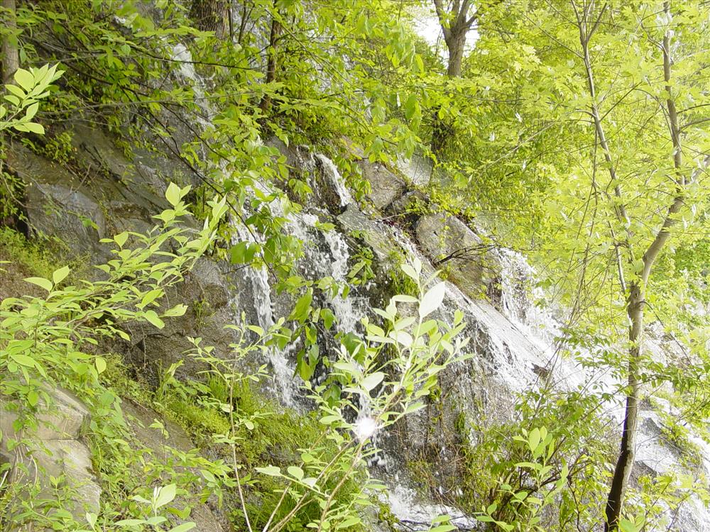
Stabilization of Mary's Wall
Persistent leaks in the canal through this stone structure has raised concerns that wall will become structurally unstable and the towpath cannot be trusted to hold the type of heavy equipment needed to properly maintain the canal or used to prepare the protective stop lock structure during flood events, thus exposing nine miles of canal and other historic structures to extensive damage during a high water event on the Potomac River.
- Water through face of Mary's Wall
U.S. National Park Service
Permission must be secured from the individual copyright owners to reproduce any copyrighted materials contained within this website. Digital assets without any copyright restrictions are public domain.
Public domain
Image
Chesapeake and Ohio Canal National Historical Park, Code: CHOH
Mile 14.06, Chesapeake and Ohio Canal National Historical Park, Montgomery County, Maryland
Latitude: 39.0047607421875, Longitude: -77.2514114379883
Latitude: 39.0047607421875, Longitude: -77.2514114379883
05/03/2006
01/01/2006
Public Can View
Thursday, December 14, 2006 3:47:54 PM
Wednesday, August 9, 2017 12:00:50 PM
CHOH-f12242883dc04b9c8da9e5d2e885e8ab.jpg
SONY SONY, CD MAVICA
10/2500 sec at f / 2.8
9.3 mm
ISO 100
Wednesday, May 3, 2006 10:09:19 AM
jpg
947.8 kB
Budget