Select Item below to DOWNLOAD - Once item is selected, right click and choose 'save as'
0a1130e8-7f17-4fed-a1b5-89d4d06bfce4
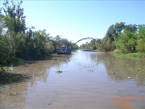
Remove Debris from Marine Waterways and Canals Jean Lafitte National Historical Park and Preserve in May 2010.
Removal of natural storm debris and fallen tress from the parks ecologivally significant Barataria-Terrebonne National Estuary in May 2010 through April 2011.
Kenta Canal 2 During -
(C) Caplio 500SE User
Public domain
Image
Jean Lafitte National Historical Park and Preserve, Code: JELA
Southeast Regional Office, Code: SERO
Southeast Regional Office, Code: SERO
Jean Lafitte National Historical Park and Preserve, Louisiana
Latitude: 29.8020095825195, Longitude: -90.1701812744141
Latitude: 29.8020095825195, Longitude: -90.1701812744141
09/28/2010
05/01/2010
Public Can View
Tuesday, March 15, 2011 11:53:02 AM
Wednesday, August 9, 2017 11:55:48 AM
JELA-50f48bac9afe457789120ffc97129395.jpg
RICOH RICOH, Caplio 500SE
1/310 sec at f / 4.7
5.8 mm
ISO 64
Tuesday, September 28, 2010 3:52:39 PM
jpg
4.9 MB
Monitoring
,
Inventory
,
Budget
Remove Debris from Marine Waterways and Canals Jean Lafitte National Historical Park and Preserve in May 2010.
Remove Debris from Marine Waterways and Canals Jean Lafitte National Historical Park and Preserve in May 2010.
Remove Debris from Marine Waterways and Canals Jean Lafitte National Historical Park and Preserve in May 2010.
Remove Debris from Marine Waterways and Canals Jean Lafitte National Historical Park and Preserve in May 2010.