Select Item below to DOWNLOAD - Once item is selected, right click and choose 'save as'
095b2780-d595-450d-907a-36614cf2f60d
Muted Topography of the Landscape
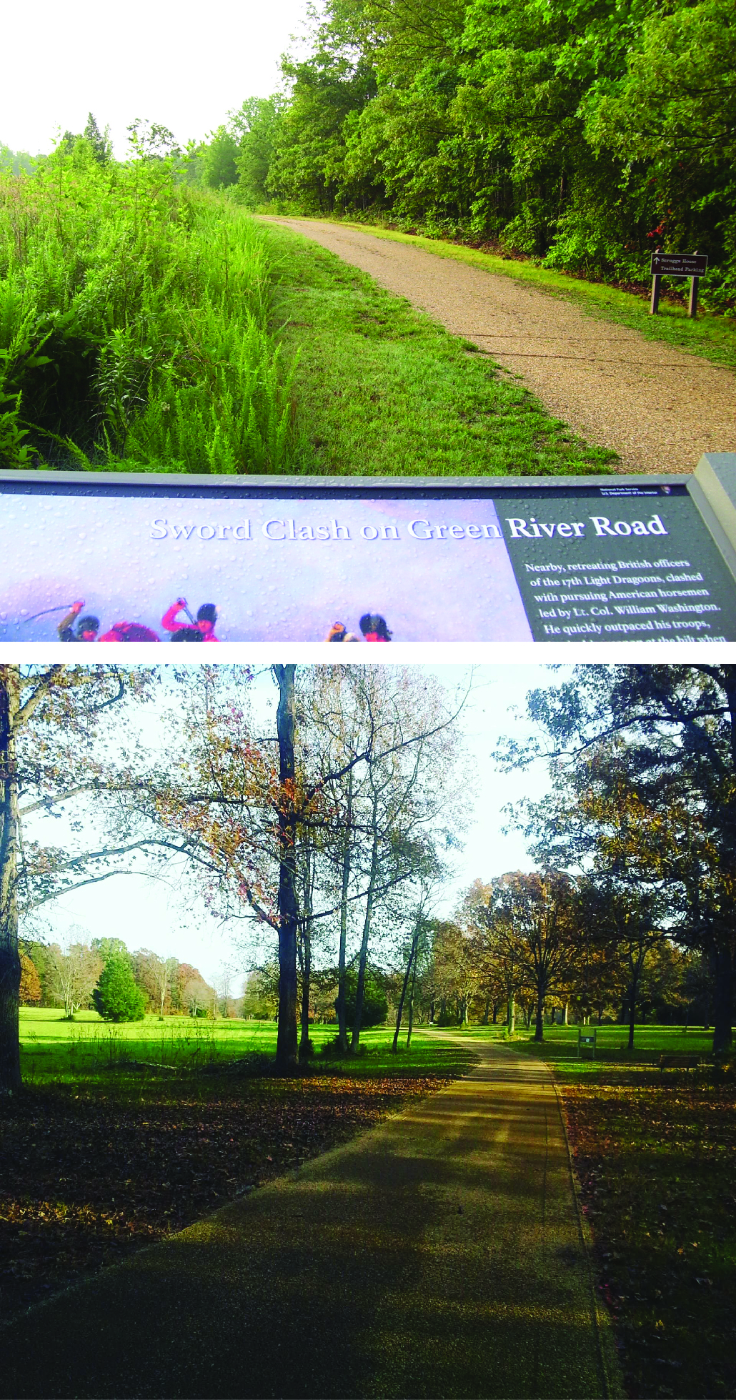
Figure 15. Photographs showing the muted topography of the landscape. Top photograph shows the Green River Road going over a gentle rise with a park sign in the foreground describing a sword clash that took place there. The bottom photograph shows the road bending across the open area of the battlefield with a few flanking trees. Caption follows.
Figure 15. Photographs showing the muted
topography of the landscape.
Though subtle, the low ridges and shallow swales (upper photograph) were effective in hiding numbers of Americans from the approaching British troops.
Permission must be secured from the individual copyright owners to reproduce any copyrighted materials contained within this website. Digital assets without any copyright restrictions are public domain.
All images are National Park Service
photographs.
Public domain:Full Granting Rights
Image
Cowpens National Battlefield, Code: COWP
Cowpens National Battlefield, Cherokee County, South Carolina
Latitude: 35.1315002441406, Longitude: -81.8093032836914
Latitude: 35.1315002441406, Longitude: -81.8093032836914
01/01/0001
Public Can View
Wednesday, May 12, 2021 10:32:36 AM
Wednesday, May 12, 2021 10:32:36 AM
COWP_15.jpg
Monday, January 1, 0001 12:00:00 AM
jpg
5.8 MB
Scenic