Select Item below to DOWNLOAD - Once item is selected, right click and choose 'save as'
086ed6a9460243a89fde9d6058947bf1
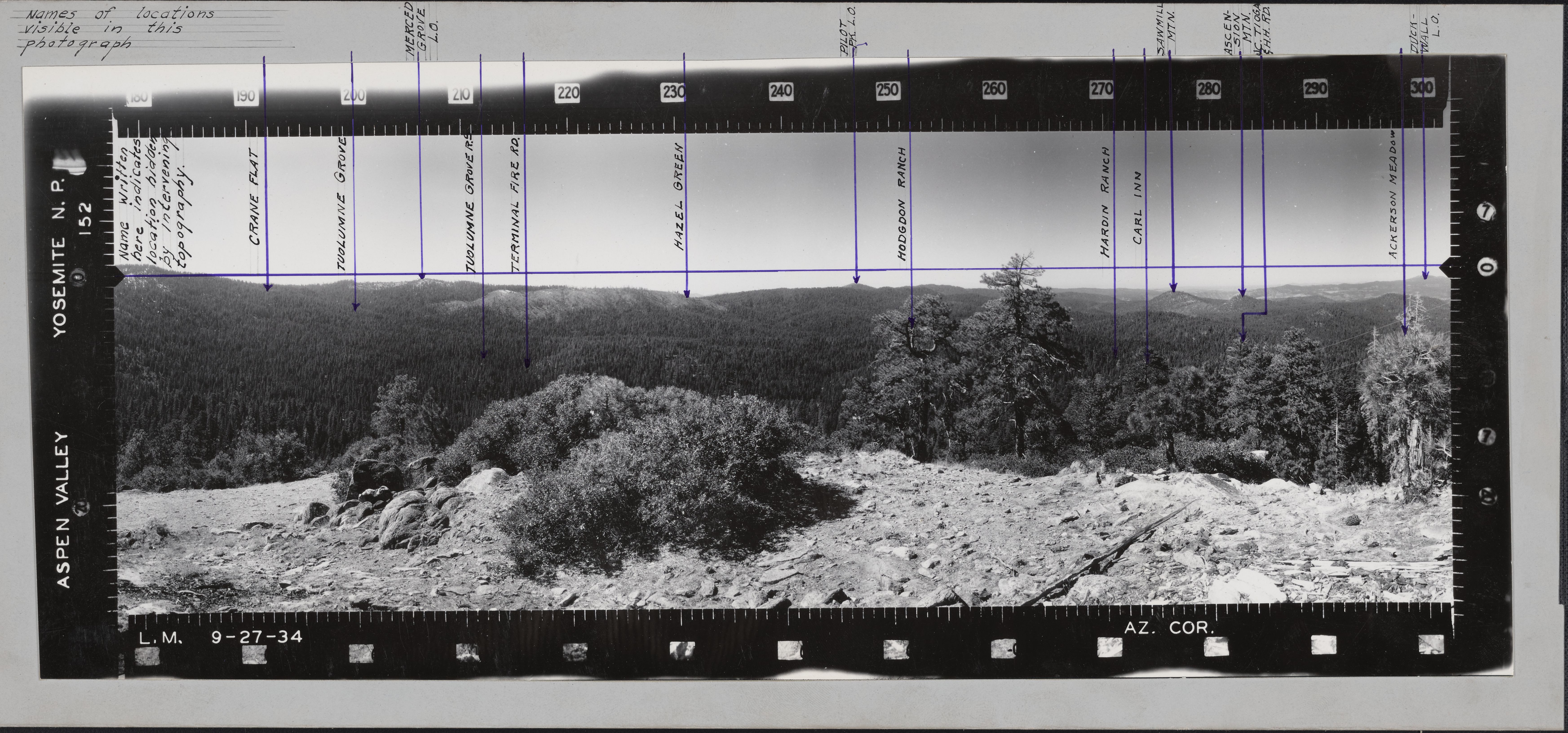
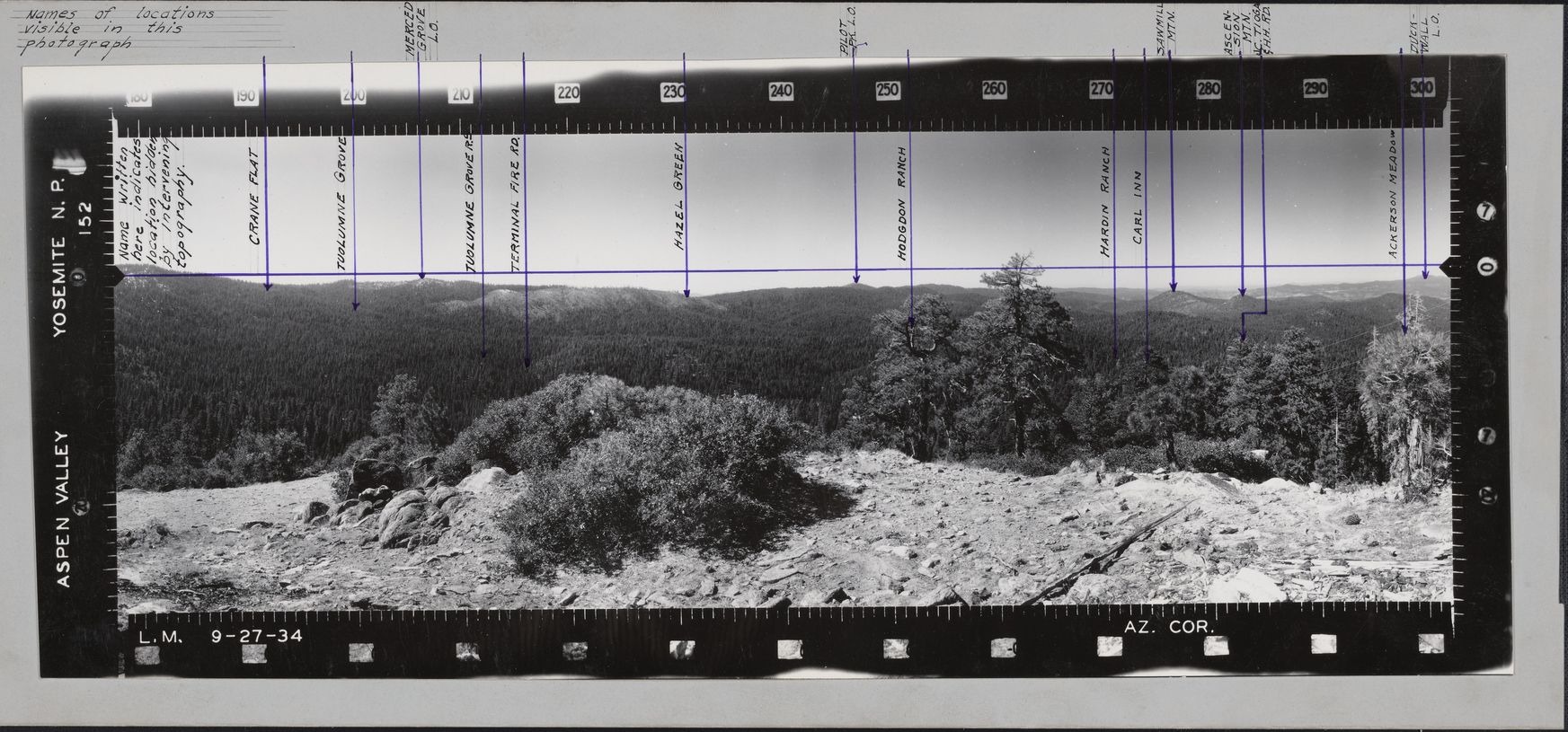
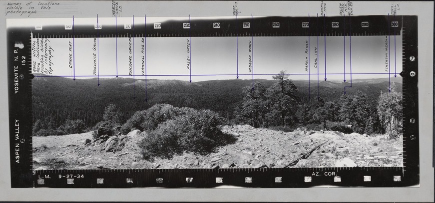
Aspen Valley
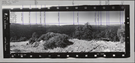
Names of locations visible in this photograph are: Merced Grove L.O., Pilot Pk. L.O., Sawmill Mtn., Ascension Mtn., J.C. Tioga H.H. RD., Duckwall L.O. Names written here indicates location hidden by intervening topography are: Crane Flat, Tuolumne Grove, Tuolumne Grove R.S., Terminal Fire RD., Hazel Green, Hogdon Ranch, Hardin Ranch, Carl Inn, Ackerson Meadow
National Park Service
Permission must be secured from the individual copyright owners to reproduce any copyrighted materials contained within this website.
Public domain
Yosemite, (LCSH)
Image
Yosemite National Park, Code: YOSE
Aspen Valley
Latitude: 37.828194, Longitude: -119.771194
Latitude: 37.828194, Longitude: -119.771194
Local Park number : ucm_yose6386_aspenvalley_001_001
9/1/2017 12:00:00 AM
01/01/1935 - 12/30/1935
panoramic photograph; tri-fold; left; slightly faded, has markings and titles. 40.5 x 17.5 cm (first of ucm_ucce_yose6386_aspenvalley_001_002 and ucm_ucce_yose6386_aspenvalley_001_003) (121.5 x 17.5 cm)
Image
Public Can View
Organization: UC Merced
Address: Yosemite National Park Archives, 5083 Foresta Road, El Portal, CA 95318
Address: Yosemite National Park Archives, 5083 Foresta Road, El Portal, CA 95318
Friday, January 19, 2018 3:19:36 PM
Friday, January 19, 2018 3:19:36 PM
ucm_yose6386_aspenvalley_001_001.tif
Phase One Phase One, IQ150
1/45 sec
ISO 200
Friday, June 30, 2017 5:20:29 AM
tif
136.7 MB
Source: Series Description
Content: Series: SERIES X: Panoramic Fire Lookout Photographs, 1934-1935, 1937
Source: Physical Description
Content: The majority of the photographs are tri-fold, mounted on heavy cardboard, and marked with tabs identifying the vantage point. The prints often contain information such as date, photographer’s initials (L.M.), and location. The photographs were originally housed in a green wooden box specifically designed for these images, stenciled “Panoramic Photographs.”
Source: Extended Description
Content: These photographs provide excellent documentation of Yosemite’s topography in the 1930s. Covering 120 degrees of the horizon, they were utilized for many decades by Yosemite lookouts to accurately locate forest fires. Today, in addition to conveying information about historic road and trail locations, changes in vegetation and landscape, and geomorphology, they provide a visual juxtaposition to later photographs that is useful for a variety of scientific, management, and administrative purposes.
Historic