Select Item below to DOWNLOAD - Once item is selected, right click and choose 'save as'
06ac9c60-72c3-4d04-9abb-3871ee854421
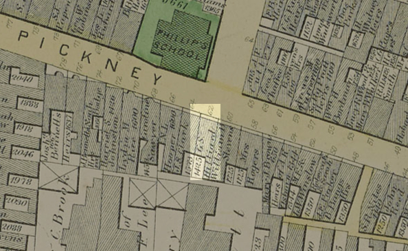
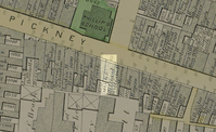
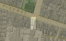
G.S. Hillard home on 62 Pinckney Street
1874 map with G.S. Hillard's home highlighted.
G.S. Hillard's home is highlighted in this Ward 6 Map (Plate L) from the 1874 "Atlas of Boston". Original map has been cropped and edited.
State Library of Massachusetts
Public domain:State Library of Massachusetts
Image
Boston African American National Historic Site, Code: BOAF
Boston African American National Historic Site, Suffolk County, Massachusetts
Latitude: 42.3578987121582, Longitude: -71.0706024169922
Latitude: 42.3578987121582, Longitude: -71.0706024169922
https://www.flickr.com/photos/mastatelibrary/9678109487/in/album-72157635389693677/
01/01/1874
09/23/2020
Public Can View
Organization: State Library of Massachusetts
Wednesday, September 23, 2020 2:34:03 PM
Wednesday, September 23, 2020 2:34:03 PM
HillardMap-Clipping.jpg
Wednesday, September 23, 2020 9:51:25 PM
jpg
259.2 kB
Historic
,
Map