Select Item below to DOWNLOAD - Once item is selected, right click and choose 'save as'
04aea3f0-a2bd-40de-9851-c0b1068997b4
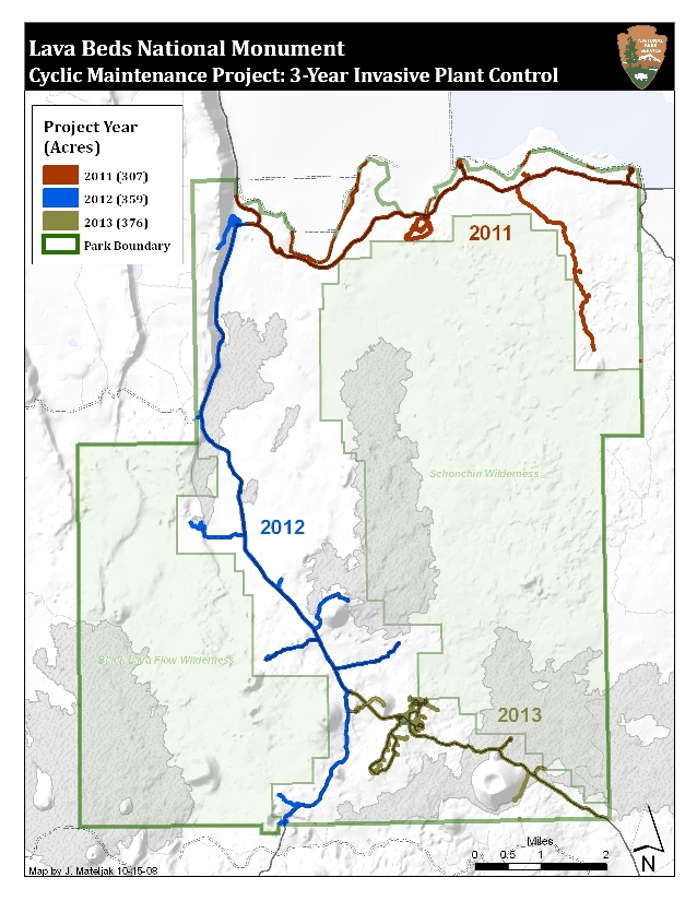
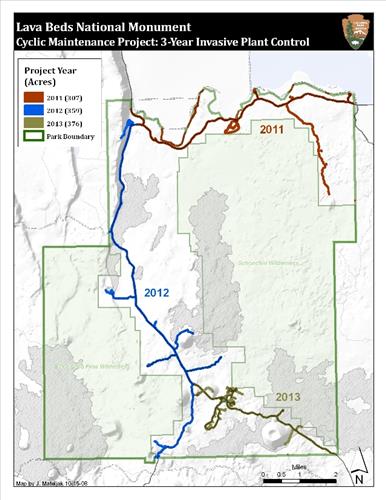
2011-2013 LABE Weed Management
Map illustrating 3-year cyclic invasive weed management project
Permission must be secured from the individual copyright owners to reproduce any copyrighted materials contained within this website. Digital assets without any copyright restrictions are public domain.
Public domain
Image
Lava Beds National Monument, Code: LABE
Lava Beds National Monument, California
Latitude: 41.7614593505859, Longitude: -121.521301269531
Latitude: 41.7614593505859, Longitude: -121.521301269531
Legacy NPS Focus Record ID : 244751
10/21/2008
Public Can View
Tuesday, October 21, 2008 6:20:56 PM
Wednesday, August 9, 2017 11:16:46 AM
LABE-a977fd12de2b4a8bb611b69e1c0ecf5c.jpg
Monday, January 1, 0001 12:00:00 AM
jpg
349.6 kB
Inventory
,
Map