Select Item below to DOWNLOAD - Once item is selected, right click and choose 'save as'
0411A851-A2A1-F098-CBE6196F6068DFE7
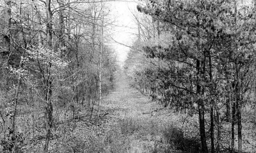
A view of Oakville Road in 1936
An unpaved lane forms a long, straight clearing through a densely wooded area of leafless trees.
Significant historic road traces on the Appomattox Court House Landscape may serve as valuable archaeological resources for further historic study. Oakville Road is one of these traces, located north of Route 24 near the North Carolina Monument.
U.S. National Park Service
Permission must be secured from the individual copyright owners to reproduce any copyrighted materials contained within this website. Digital assets without any copyright restrictions are public domain.
NPS Photo (APCO)
Public domain:Full Granting Rights
Image
Appomattox Court House National Historical Park, Code: APCO
Latitude: 37.37756, Longitude: -78.79605
Appomattox Court House National Historical Park, Appomattox County, Virginia
Latitude: 37.3827018737793, Longitude: -78.8009033203125
Appomattox Court House National Historical Park, Appomattox County, Virginia
Latitude: 37.3827018737793, Longitude: -78.8009033203125
1936
Public Can View
Person: lnigro
Thursday, April 11, 2019 6:40:53 AM
Thursday, April 11, 2019 6:40:53 AM
04364253-BF9A-D98D-DCC3197988D5EFD3.JPG
Monday, January 1, 0001 12:00:00 AM
jpg
92.7 kB
Scenic