Select Item below to DOWNLOAD - Once item is selected, right click and choose 'save as'
037aaaa3-7d53-48a8-a05c-6a20dc62e5d8
COLO
Jamestown Historic Research Cntr 42J570A5
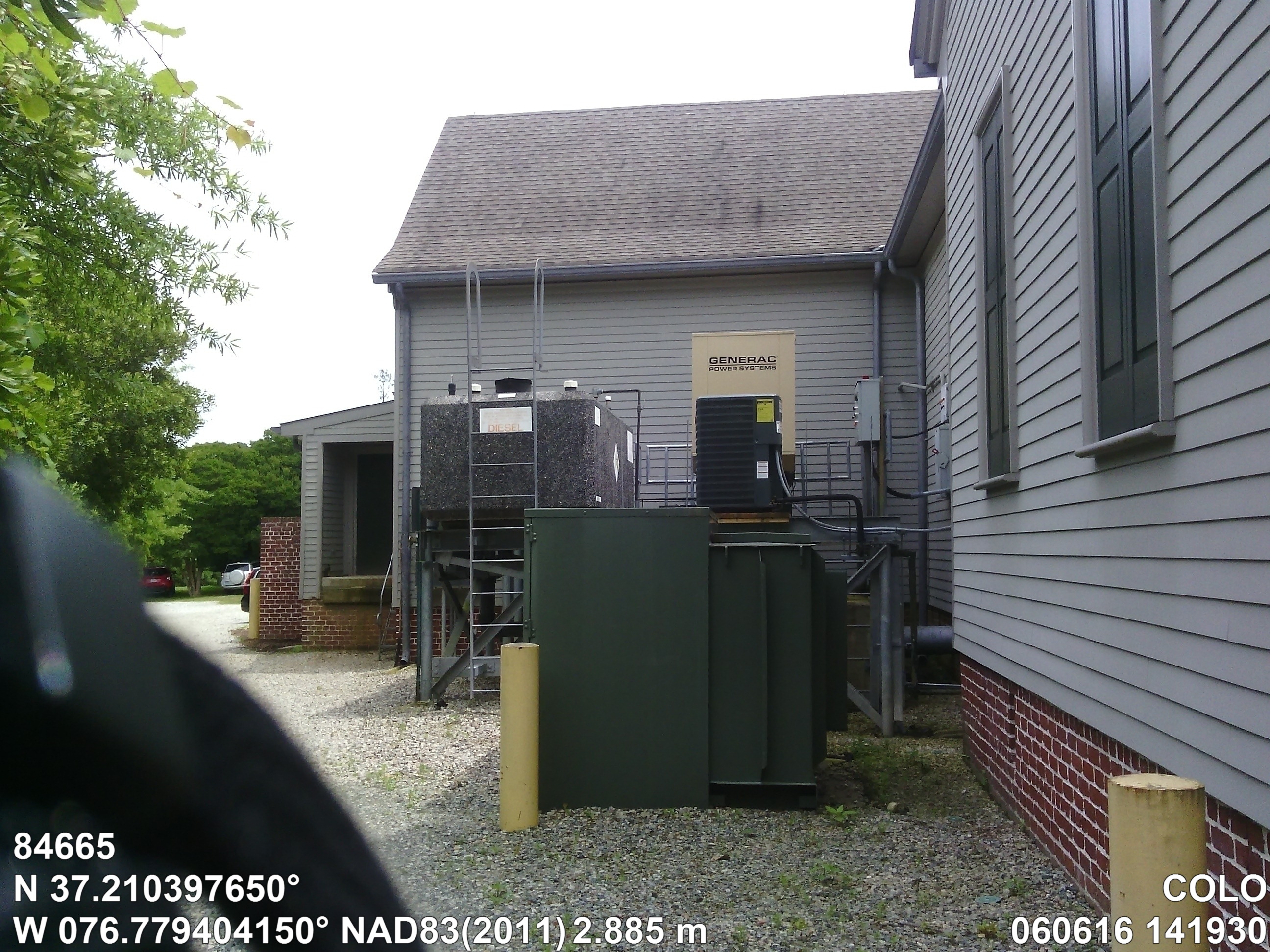
Image with visible watermark of coordinates, elevations date, time and park code.
84665
4100
Permission must be secured from the individual copyright owners to reproduce any copyrighted materials contained within this website. Digital assets without any copyright restrictions are public domain.
Public domain
Asset Inventory, (NPS Focus Subject Thesaurus)
, Coastal, (NPS Focus Subject Thesaurus)
, Elevations, (NPS Focus Subject Thesaurus)
, FMSS, (NPS Focus Subject Thesaurus)
, Coastal, (NPS Focus Subject Thesaurus)
, Elevations, (NPS Focus Subject Thesaurus)
, FMSS, (NPS Focus Subject Thesaurus)
Image
Colonial National Historical Park, Code: COLO
Virginia
Latitude: 37.21039765, Longitude: -76.77940415, Elevation: 2.885
Latitude: 37.21039765, Longitude: -76.77940415, Elevation: 2.885
FMSS (Location Number) : 84665
06/06/2016
06/06/2016
Public Can View
Organization: FMGIS
Email: Brian_Diethorn@partner.nps.gov
Email: Brian_Diethorn@partner.nps.gov
Tuesday, December 13, 2016 4:42:21 PM
Wednesday, August 9, 2017 11:14:46 AM
84665_060616_141930[2]_tag.jpg
Pegatron Pegatron, Getac Z710
1270/1000000 sec at f / 2.8
3.37 mm
ISO 71
Monday, June 6, 2016 8:17:03 PM
jpg
3.1 MB
Source: LOCALTIDAL_MSL
Content: 2.922
Content: 2.922
Inventory