Select Item below to DOWNLOAD - Once item is selected, right click and choose 'save as'
010d1cf711d34f8b86a7efedea877b8c
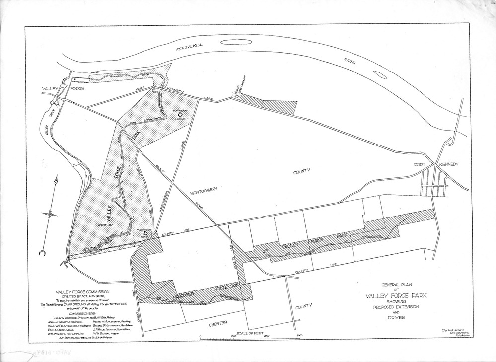
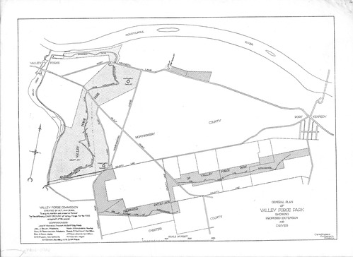
General Plan of Valley Forge Park Showing Proposed Extension and Drives
Jacob Orie Clarke Collection, General Encampment, Valley Forge Park
MapId: 20 MapNo: A20 Material: vellum
U. S. National Park Service
Good, Clarke?Hubbard Civil Engineers, Philadephia PA
Permission must be secured from the individual copyright owners to reproduce any copyrighted materials contained within this website.
Restrictions apply on use and/or reproduction
Image
Valley Forge National Historical Park, Code: VAFO
Valley Forge National Historical Park, Pennsylvania
Latitude: 40.0988998413086, Longitude: -75.4446334838867
Latitude: 40.0988998413086, Longitude: -75.4446334838867
20180420
05/30/1893
11 3/4" x 8 1/2"
Public Can View
Person: Curator
Organization: US National Park Service
Address: Valley Forge National Historic Park, King of Prussia PA
Organization: US National Park Service
Address: Valley Forge National Historic Park, King of Prussia PA
Tuesday, April 24, 2018 8:15:52 AM
Tuesday, April 24, 2018 8:15:52 AM
VAFO 61083 A 20 General Plan Proposed Extension and Drives nd.jpg
jpg
1.6 MB
Historic