Select Item below to DOWNLOAD - Once item is selected, right click and choose 'save as'
009fc511-01c6-4e8b-aa39-fc925ccaaacb
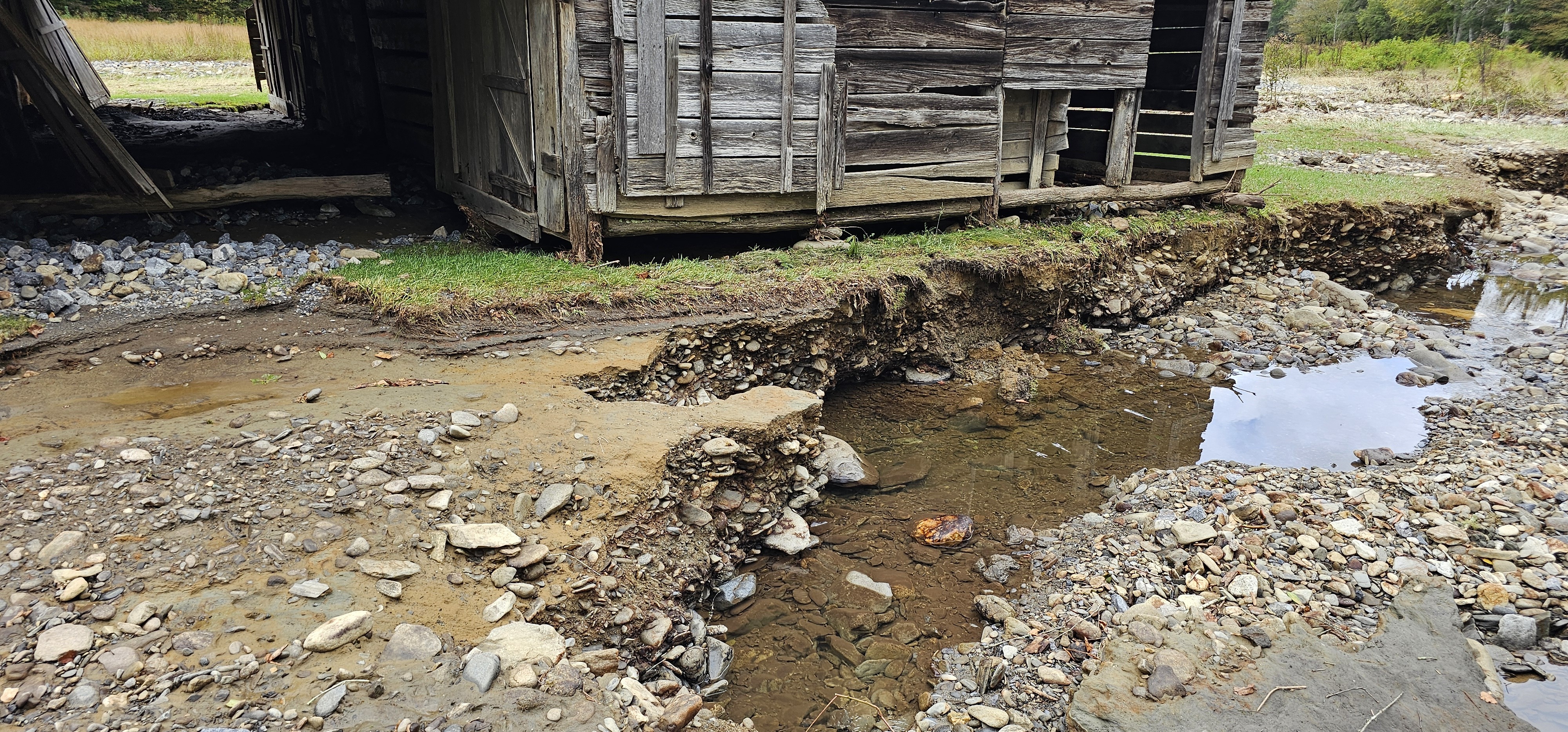
Road damage near Caldwell Barn.jpg
Photo shows erosion Upper Cataloochee Valley Road, near Caldwell Barn
Upper Cataloochee Valley Road sustained significant damage from flooding from Rough Fork Creek.
Permission must be secured from the individual copyright owners to reproduce any copyrighted materials contained within this website. Digital assets without any copyright restrictions are public domain.
NPS
Public domain:Full Granting Rights
Image
Great Smoky Mountains National Park, Code: GRSM
Great Smoky Mountains National Park
Latitude: 35.5715599060059, Longitude: -83.528190612793
Latitude: 35.5715599060059, Longitude: -83.528190612793
10/01/2024
10/01/2024
Public Can View
Thursday, October 10, 2024 8:49:13 PM
Friday, October 11, 2024 4:13:41 PM
Road damage near Caldwell Place.jpg
samsung samsung, Galaxy S23 Ultra
1/120 sec at f / 1.7
6.3 mm
ISO 16
Tuesday, October 1, 2024 1:44:20 PM
jpg
4.4 MB
Scenic