Select Item below to DOWNLOAD - Once item is selected, right click and choose 'save as'
816c1121-bf1e-4dda-a25e-df7efc158463
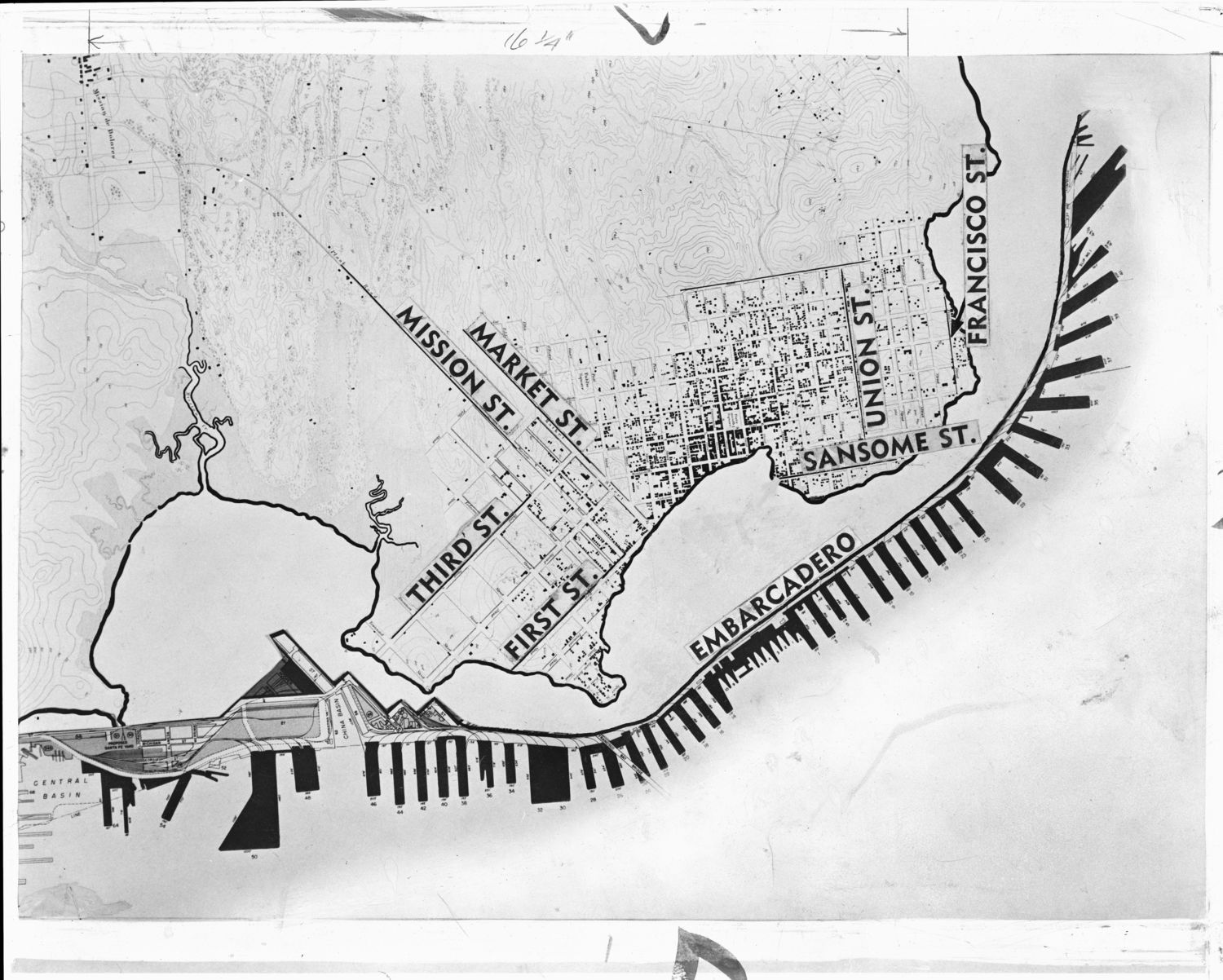
Map of San Francisco waterfront, CA, circa 1848 and 1957
Information on back of print: "Contrast between San Francisco's shoreline in gold-rush days and the present waterfront as established by seawall construction started in 1867 is shown in this State Harbor Board chart. Six-mile seawall underlies the city's Embarcadero, running from vicinity of Aquatic Park to 3rd St. Channel at China Basin." [CR][CR]From John Kemble's book, "San Francisco Bay: A Pictorial Maritime History," page 11, and has the following caption:[CR] "The waterfront of 1957 compared with that of 1848....The six-mile seawall underlying the Embarcadero from the vicinity of Aquatic Park at the right to the Third Street Channel at China Basin marks the San Francisco waterfront of the mid-twentieth century. All the tidal land lying behind it running back to the high water mark of 1848 has been filled with debris obtained from the hills of the city. The piers are shown jutting out into the bay from the Embarcadero with the Ferry Building in about the center. Toward the left, the largest of the piers is the Mission Rock Terminal. (Courtesy of the San Francisco Chronicle.)"
U. S. National Park Service
Permission must be secured from the individual copyright owners to reproduce any copyrighted materials contained within this website. Digital assets without any copyright restrictions are public domain.
Restrictions apply on use and/or reproduction:This image is for research and study purposes only. This work may be protected by U.S. copyright law (Title 17, U.S. Code), which governs reproduction, distribution, public display, and other uses of protected works. Uses may be allowed with permission from the copyright holder, or if the copyright on the work has expired, or if the use is "fair use" or within another exemption. The user of this work is responsible for compliance with the law.
Image
San Francisco Maritime National Historical Park, Code: SAFR
NPS Museum Number Catalog : SAFR 21374
Local Park number : P93-065, Series 1, File Unit 11, Item A11.15005
Local Park number : P93-065, Series 1, File Unit 11, Item A11.15005
Title: Guide to the San Francisco Maritime Museum classified photograph collection, 1575-1984 located on the Online Archives of California website.
URL: http://www.oac.cdlib.org/findaid/ark:/13030/c8hm5f30/
URL: http://www.oac.cdlib.org/findaid/ark:/13030/c8hm5f30/
09/27/2016
Image
Organization: San Francisco Maritime National Historical Park
Address: 2 Marina Boulevard, Building E, 2nd Floor, San Francisco, California 94123
Email: safr_maritime_library@nps.gov
Address: 2 Marina Boulevard, Building E, 2nd Floor, San Francisco, California 94123
Email: safr_maritime_library@nps.gov
Friday, January 20, 2017 10:30:21 PM
Friday, January 20, 2017 10:30:21 PM
safr_21374_p93-065-01-11-a11-15005_deri.tif
Monday, January 1, 0001 12:00:00 AM
tif
24.5 MB
Historic
,
Map