Select Item below to DOWNLOAD - Once item is selected, right click and choose 'save as'
13ba3ce9-2cd4-4e1f-ba44-42fff8a9404a
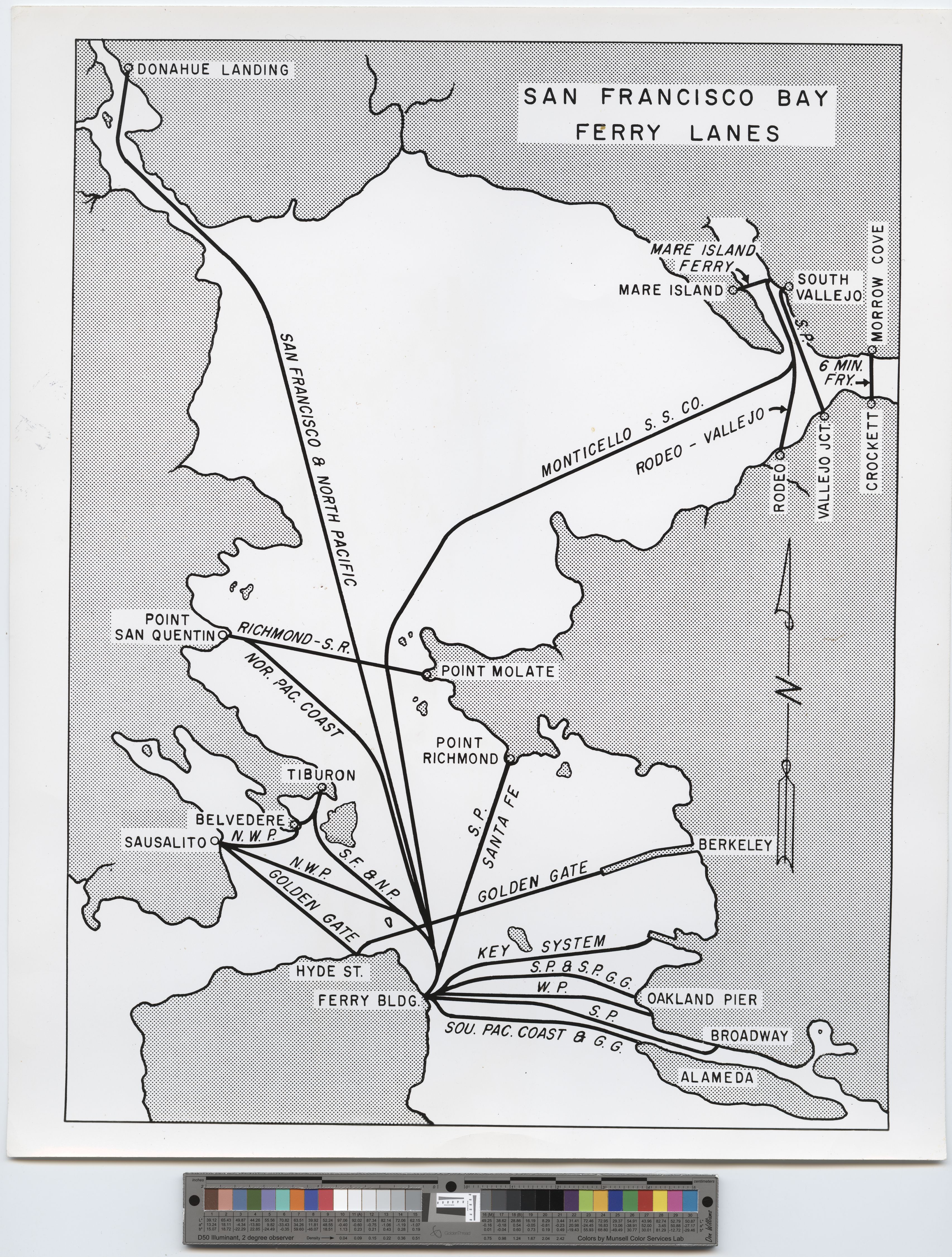
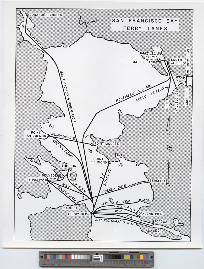
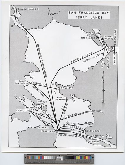
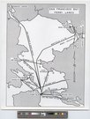
Ferry lanes in the San Francisco Bay, CA, undated
Photo of a map which diagrams the various routes. Map goes as far north as Donahue Landing in the North Bay and as far south as Alameda. Crockett is the most easterly extreme. SAN FRANCISCO BAY FERRY LANES
U. S. National Park Service
Permission must be secured from the individual copyright owners to reproduce any copyrighted materials contained within this website. Digital assets without any copyright restrictions are public domain.
Restrictions apply on use and/or reproduction:This image is for research and study purposes only. This work may be protected by U.S. copyright law (Title 17, U.S. Code), which governs reproduction, distribution, public display, and other uses of protected works. Uses may be allowed with permission from the copyright holder, or if the copyright on the work has expired, or if the use is "fair use" or within another exemption. The user of this work is responsible for compliance with the law.
Image
San Francisco Maritime National Historical Park, Code: SAFR
NPS Museum Number Catalog : SAFR 21374
Local Park number : P93-065, Series 2, File Unit 10, Item B10.18304
Local Park number : P93-065, Series 2, File Unit 10, Item B10.18304
Title: Guide to the San Francisco Maritime Museum classified photograph collection, 1575-1984 located on the Online Archives of California website.
URL: http://www.oac.cdlib.org/findaid/ark:/13030/c8hm5f30/
URL: http://www.oac.cdlib.org/findaid/ark:/13030/c8hm5f30/
09/27/2016
Image
Organization: San Francisco Maritime National Historical Park
Address: 2 Marina Boulevard, Building E, 2nd Floor, San Francisco, California 94123
Email: safr_maritime_library@nps.gov
Address: 2 Marina Boulevard, Building E, 2nd Floor, San Francisco, California 94123
Email: safr_maritime_library@nps.gov
Friday, January 20, 2017 8:48:04 PM
Friday, January 20, 2017 8:48:04 PM
safr_21374_p93-065-02-10-b10-18304_deri.tif
Monday, January 1, 0001 12:00:00 AM
tif
26.2 MB
Scenic
,
Historic
,
Map