Select Item below to DOWNLOAD - Once item is selected, right click and choose 'save as'
6908abe0-12be-4098-8165-6db7241eb43d
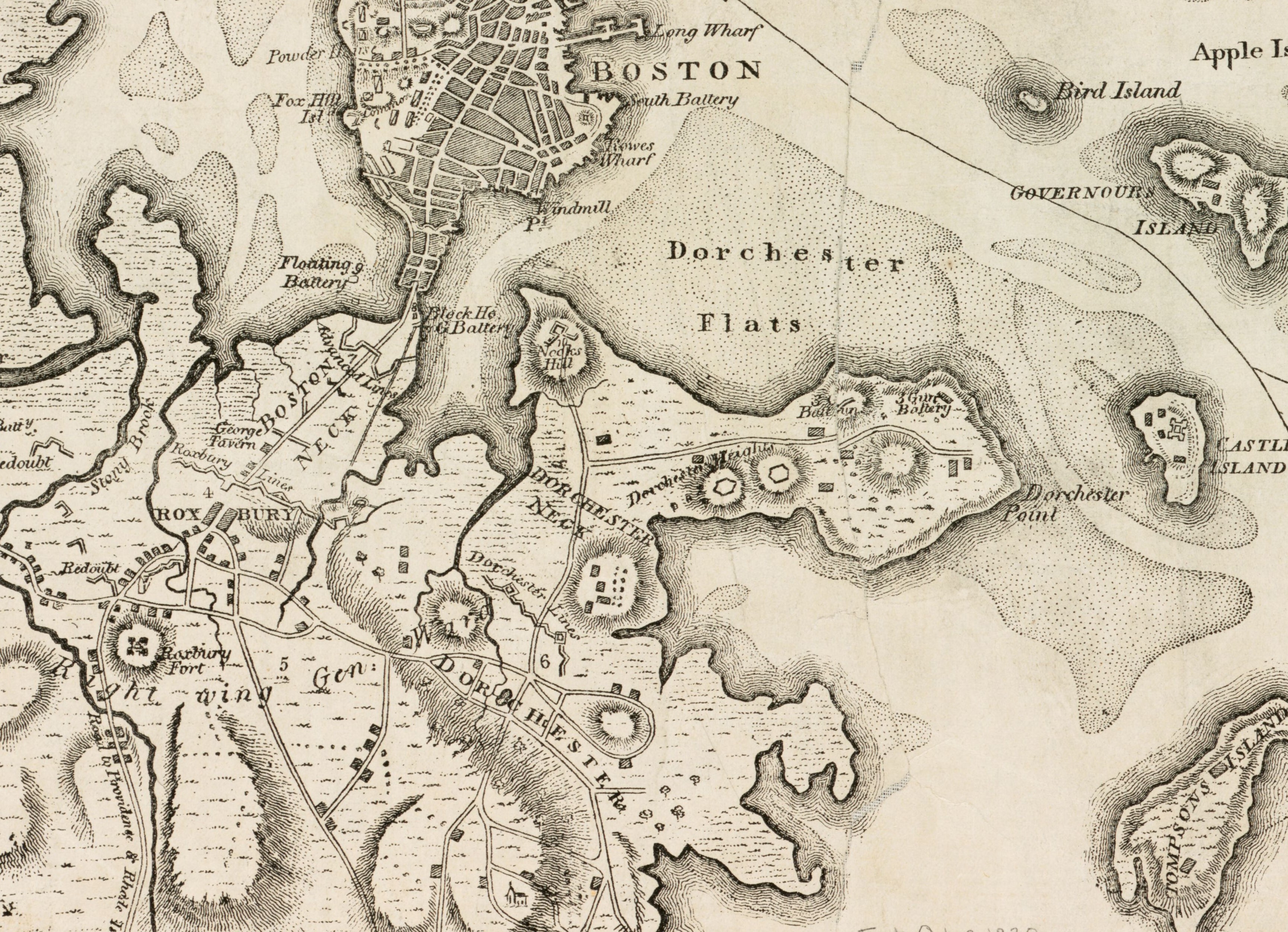
Gen. Washington's Revolutionary Campaign War Map
Black and white map of Boston, Roxbury, and Dorchester Heights.
General Washington's Revolutionary War campaign war map showing the position of his army in defence of Boston in 1776. It also shows the fortifications and gun batteries in Roxbury and Dorchester Heights.
Boston, Mass : A.O. Crane
This image is used for the Luther Jotham (Patriot of Color) story map.
Digital Commonwealth states there are no known restrictions. See this url for more information: https://www.digitalcommonwealth.org/search/commonwealth:wd3768027
Public domain:Digital Commonwealth states there are no known restrictions.
Image
Boston National Historical Park, Code: BOST
Boston National Historical Park, Suffolk County, Massachusetts
Latitude: 42.3734016418457, Longitude: -71.0557022094727
Latitude: 42.3734016418457, Longitude: -71.0557022094727
https://www.digitalcommonwealth.org/search/commonwealth:wd3768027
01/01/1875
01/18/2022
Public Can View
Organization: Norman B. Leventhal Map Center/Digital Commonwealth
Wednesday, January 19, 2022 8:18:39 AM
Wednesday, January 19, 2022 9:02:04 AM
Dorchester Heights Map.jpg
Tuesday, January 18, 2022 11:54:38 PM
jpg
2.5 MB
Historic